Research Focus & Interests
Since 1922, Trelease Woods has been censused approximately every decade to varying extents. The Trelease Woods Forest Dynamics Plot aims to:
- Standardize the forest census protocol used at Trelease, while building upon the century-long historic record of forest composition.
- Examine long-term changes in regional forest composition due to climate change and disturbance, and evaluate the effects of compositional changes on nutrient storage and cycling.
- Extend the ForestGEO dataset of Midwest forests, joining the Tyson Research Center in Missouri, Lilly Dickey Woods in Indiana, Wabikon in Wisconsin, and Michigan Big Woods.
- Create opportunities for undergraduate students to gain hands-on research experience through in-field data collection and class projects using census data.
Plot Design
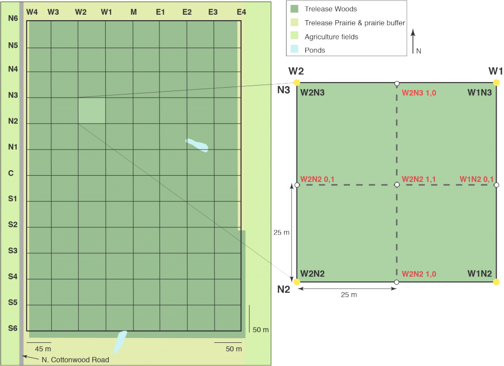
The Trelease Woods Forest Dynamics Plot was originally surveyed and gridded in 1939. The plot consists of 96 quadrats each subdivided into 4 subquadrats. The forest is border on 3 sides by a prairie buffer, beyond which is agricultural fields. The western edge is border by a road.