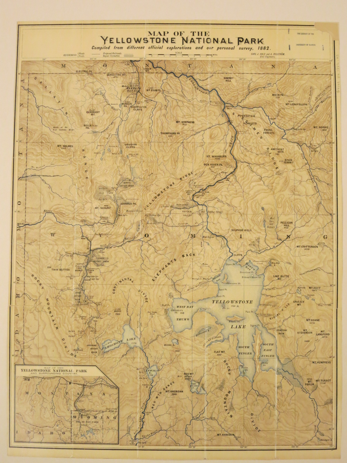
This map, intended for early tourists to the Park, shows roads, trails, areas of geyser formation, and a proposed railroad line. The railway was planned to run north-south through the western portion of the Park from Mammoth Hot Springs, past Elk Park, through Geyser Basin, along the south shore of Shoshone Lake, and then south following the Lew’s Fork.
Map of the Yellowstone National Park : compiled from different official explorations and our personal survey, 1882 / Carl J. Hals and A. Rydstrom, civil engineers. Scale approximately 1:184,000. St. Paul : Chas. S. Fee, [1884]. Map Library call number G4262.Y4 1882 .H3