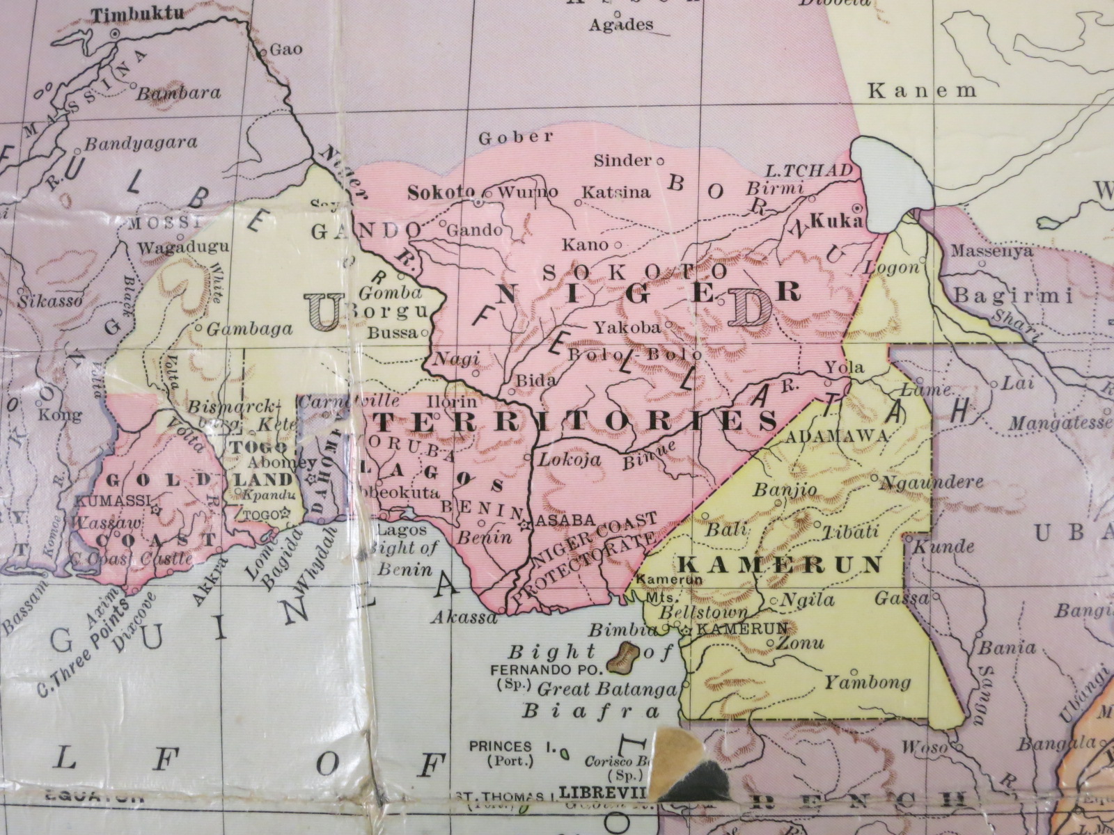
Prior to the First World War, map publishers showed “firm” boundaries between territories as well as amorphous limits of influence. Note the strong diagonal border between Niger and Kamerun in comparison to the fluid-appearing division between Niger and the French-controlled Sahara Desert to the north.
A portion of: Map of Africa : changes of half a century / drawn and engraved expressly for The Independent ; Bradley & Poates, engravers. Scale approximately 1:22,000,000. New York : The Independent, c1898. Map Library call number: G8201.S3 1898 .I5