Vegetation Monitoring Protocols
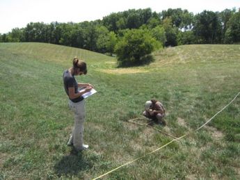
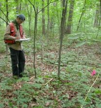
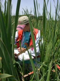 At each site, biologists collect data on herbaceous and woody vegetation.
In forests they establish three 50 m transects and set 10 0.25 square m2 quadrats along each transect to estimate ground cover using a modified Daubenmire method. Also, along each transect they establish a 4 m × 50 m shrub plot and a 10 m × 50 m tree plot.
In wetlands and grasslands the INHS scientists use a single 41 m transect. Along this transect they place twenty 0.25 m2 quadrats to estimate ground cover and establish a 4 m × 41 m shrub plot and 41 m × 50 m tree plot. The locations of the center point and transects at each site are geo-referenced to facilitate relocation.
 Plant site visits to date: 1,572
- 162 sites sampled 4 times
- 219 sites sampled 3 times
- 72 sampled 2 times
- 123 sampled 1 time
- 2,666 total transects
- 38,415 total quadrats
Abundance Trends and Distribution Maps
We have summarized trends in abundance for the plant species observed by CTAP since 1997 in forests, wetlands, and grasslands. See maps of abundance data for the most common plant species, as well as approximate observation locations here.