Backcountry geysers

Image

Since I take students to the national parks every other year, I can get a bit jaded visiting frontcountry thermal areas like Old Faithful, Norris, or Midway.

Trailside Geyser.


In recent years, I’ve begun to visit backcountry sites. I’m much happier now.

Why? See my article on the Shoshone Geyser Basin in National Parks Traveler, here.

Arkansas Post in the Civil War

Painting in the visitor center.

Arkansas Post in the Civil War

Even if you know a fair amount about the Civil War, you may not have heard of the Battle of Arkansas Post. It doesn’t make the indices of the one-volume histories on my shelf. Though a significant action in the Vicksburg Campaign, it was not part of Grant’s widely-studied maneuvers that led to Vicksburg’s fall.

The great egrets seem to like having the battlefield underwater.

The military historians don’t have much of a story to tell at Arkansas Post National Memorial, the site of a brief siege in 1863. First of all, most of the relevant battlefield is underwater, either washed away by the changing channels of the Arkansas River or flooded behind a dam project managed by the US Army Corps of Engineers. Only some rifle trenches from 1863 remain to interpret.

Second, military historians like to focus on battlefield tactics and, to a lesser extent, the operational decisions generals make at the campaign level. Those are not very interesting here since the story consists of overwhelming land forces accepting Fort Hindman’s surrender after Union naval guns pound the fort into submission. A park brochure (McCutchen 2003) tells that story, along with three signs along the park’s entrance road, near the rifle pits.

Lots of politics! The six flags of Arkansas Post’s history.

By seeing it in military terms, the park narrative misjudges events at Arkansas Post. The Civil War Battle of Arkansas Post (Fort Hindman) was a political victory by a political general, Major General John McClernand. As it turns out, the most interesting—and most important—aspect of the battle concerns McClernand and army politics.

McClernand was an ally of Stephen Douglas, presidential candidate of the Illinois Democratic Party, and a member of the national House of Representatives from Illinois from 1843 to 1851. He also filled a vacancy in the House briefly in 1860. Though he supported Douglas for president in 1860, McClernand was also a friend of Republican candidate Abraham Lincoln. Appointing him as a brigadier general helped President Lincoln maintain relationships with the Democratic Party at home, at a time when many in southern Illinois had Confederate sympathies.

Though vainglorious and self-serving to an extent that annoyed his military colleagues, McClernand proved to be a more reasonable soldier than many other political generals. His success at Arkansas Post was balanced by weaknesses in performance at Fort Donelson and Champion Hill, though a tenacity on defense at Shiloh balanced his slow movements on the advance. Capturing Fort Hindman was not without military advantages, but interpretation exaggerates them. Remarkably, McClernand’s success at Arkansas Post led to his removal.

Rear Admiral David D. Porter brought some city-class gunboats.

As commander of the Army of Tennessee, Major General Ulysses S. Grant thought his subordinate’s operation a “wild-goose chase” that diverted a large force of soldiers, transports, and gunboats away from the planned assault on Vicksburg. Historian Brian McCutchen (2003: 2; see also Coleman 1987/2009: 116) provides a more sober summary that, “Although Union losses were high and the victory did not contribute to the capture of Vicksburg, it did eliminate one more impediment to Union shipping on the Mississippi.” That said, McClernand undertook the operation without telling his commander until it was already underway.

Commanding, Grant did not think that prize worth the effort. As he saw it, McClernand diverted forces away from Vicksburg and from Grant’s plans to link up with General Nathaniel Banks as the Army of the Gulf moved upriver from New Orleans. As a general principle, Grant believed it unwise to divide his forces to achieve any goal other than the main objective, and that goal was Vicksburg. This guided his reply to McClernand when he learned what was afoot:

“I do not approve of your move on the Post of Arkansas while the other [Vicksburg] is in abeyance. It will lead to the loss of men without a result . . . . It might answer for some of the purposes you suggest, but certainly not as a military movement looking to the accomplishment of the one great result, the capture of Vicksburg. Unless you are acting under authority not derived from me, keep your command where it can soonest be assembled for the renewal of the attack on Vicksburg.” (quoted in Foote 1963: 137)

Replica of a gun from the period of Spanish Louisiana. But you get the idea.

Grant also informed the General-in-Chief, Henry Halleck, of the action against Arkansas Post. Halleck backed him up, authorizing Grant to relieve General McClernand from command of the Vicksburg campaign, “giving it to the next in rank or taking it yourself” (quoted in Foote 1963: 137). Since McClernand was friends with Lincoln, Halleck presumably cleared this action with the president. Because McClernand enjoyed public acclaim after his success at Arkansas Post, Grant held back from dismissing him immediately “until the time was right to pounce” (Foote 1963: 138).

These internal Army maneuvers were clearly important for the war, but only in hindsight. With McClernand out of the way, Grant could begin planning the campaign against Vicksburg. After some false starts, he ended up producing a model campaign, swinging south and then east of the objective, ignoring his lines of supply and communication to points east of Vicksburg. From there he moved first to take the capital of Jackson before turning west to besiege and then conquer Vicksburg.

That campaign is a classic of American military history, and is rightly featured in interpretation at Vicksburg National Battlefield Park. It would not have happened if McClernand had remained in command of the Vicksburg operations.

None of this appears at Arkansas Post, however. Interpretation does not seem to mention that Grant had McClernand relieved for his actions at Arkansas Post. Instead, the park explains the battle in traditional military terms. A panel in the Visitor Center (“January 1863”) describes the Union attack as a “response to Confederate raids on shipping on the Mississippi.” However, any threat to Union shipping from Confederate gunboats was minor; Fort Hindman could be bypassed at this point in the war. Still, the fort had had some value earlier in the war, which is why Confederate engineers chose to build a fort here, to protect trade along the Arkansas River (Visitor Center, Panel, “Defending the Delta”).

The Daughters of the American Revolution helped pay for this replica Spanish cannon. They are stakeholders here too.

Interpretation reflects the bureaucratic interests of the National Park Service as well as the biases of military historians. As is true at most historic sites, the NPS has a stake in making the events here seem important—whether they are or not. The park’s resource study (Coleman 1987/2009) and administrative history (Carrera 1975/1987) emphasize the military events on site and what little physical evidence remains of them. Though the resource studies mention the political context briefly, park interpretation does not.

Of course, all authors bring their own biases to any narrative. Like most biographers, Ron Chernow (2017: 241) sees the story from Grant’s perspective, emphasizing his successes in internal Army politics while downplaying McClernand’s military successes. Shelby Foote (1963: 133-136) balances the political and the military, as does Robert Huffstot (1969). Both are more attuned to the political context of any war, and my perspective is closer to theirs than to other texts I’ve consulted.

Gunboats are not the only thing with armor at Arkansas Post today.

In fairness, the capture of Arkansas Post did have some military advantages that Grant may not have anticipated. First, the battle strengthened Union morale after the defeat at Chickasaw Bayou (December 26–29, 1862). Indeed, finding a reasonably-sized military success had been a goal of generals McClernand and Sherman when they met with Rear Admiral David Porter to decide their next moves (Huffstot 1969: 4-5).

A second important outcome of the battle was the Union capture of almost five thousand rebels, a considerable share of all Confederate forces in Arkansas. With the Union’s successful repulse of a Confederate advance at the Battle of Prairie Grove on December 7, 1862, Lieutenant General Theophilus Holmes’s Trans-Mississippi Department would remain on the defensive (Huffstot 1969).

The park’s focus on battlefield events in 1863 overlooks those military consequences, whether on the Army’s morale, national public opinion, or the weakening of the Confederate position in Arkansas and the Trans-Mississippi theater. The effect on Army politics, by allowing Grant to take over command of the Vicksburg campaign from McClernand, was even more important, paving the way for Lincoln to “put that key in his pocket.”

The NPS marks the town site by paving the historic streets, showing the layout.

REFERENCES

Carrera, Gregorio S.A. 1975/1987. Arkansas Post National Memorial Administrative History. US Department of Interior: National Park Service.

Chernow, Ron. 2017. Grant. New York: Penguin.

Coleman, Roger E. 1987/2009. The Arkansas Post Story: Arkansas Post National Memorial. US Department of the Interior: National Park Service, Southwest Cultural Resources Center, Professional Papers No. 12. Eastern National.

Foote, Shelby. 1963. The Civil War: A Narrative. Volume II: Fredericksburg to Meridian. New York: Random House.

Huffstot, Robert S. 1969. “The Battle of Arkansas Post.” Historical Times, Inc.: Civil War Times Illustrated.

McCutchen, Brian K. 2003. “The Battle of Arkansas Post ~ January 9-11, 1863: Overview and troop positions.” US Department of Interior: National Park Service, Arkansas Post National Memorial.

Yellowstone backcountry campsites

This page reviews my experiences at many of Yellowstone’s backcountry campsites, both those where I have camped and those I have only seen along the trail. (I have eaten lunch at some of those.)  I have about 350 miles of backpacking experience in the park, though about half of those miles are “repeat” miles. Those miles include both personal trips and those in which I have led a group.

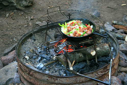
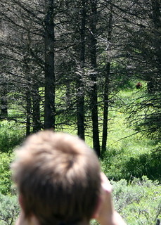
I’ve taken Illinois students backpacking in Yellowstone four times in late June and three times in late July. There are still bear closures in most of June, which rules out a number of sites I’d like to use. Even in late July some places still restrict off-trail travel. Most sites are limited to eight people, so I have often needed two sites for the short backpacking trips. The online reservation system and permit lottery now makes this two-site strategy difficult; in the past, backcountry rangers were helpful in providing options and explaining the rules in such cases.

Two of those group trips have gone to the Thorofare because it has a lot of 12-person sites. We limited group size to make that work.

My student groups have generally consisted of backpacking novices, though the two Thorofare trips had many experienced members. I’ve learned that it’s best to aim for distances around 2-5 miles, which works well for overnights or three-day weekends. Grebe Lake is at the low end of that range, the Gardiner sites at the higher end. For groups of 4-6 people, Heart Lake sites would be great but they are nine miles from the trailhead. The Snake River sites would also be great. Later in the season you can ford the Snake at the South Entrance; earlier in the season, you use an informal trail south of the park, across a bridge, and park on the east side of the river. That adds a couple of miles.

The Thorofare trips need people who can cover more miles since the minimum round-trip distance is 65 miles (plus spur trails to camping sites). I would recommend at least six nights, planning on days of 8-12 miles.

In addition to advice for backcountry groups, I thought I’d add reviews of other sites I’ve used. I’ve compared my impressions to Bill Schneider’s Hiking Yellowstone, which reviews every hiking site in the park. The park retires sites regularly, or restructures trails. Some of my reviews are updates to Schneider’s book. I have also drawn from the data in Thomas Bohannan’s Yellowstone Trail and Backcountry Field Guide.

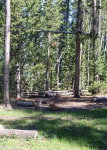
One frustration in Yellowstone’s backcountry is that most official sites don’t follow the park rules. Ideally, your sleeping area, cooking area, and food storage area should each be 100 yards apart. You should sleep upwind of the cooking and food storage so that those food smells don’t lead a bear to your sleeping area. Not one of the sites reviewed here follows all of those rules. Most of them have a fire ring and cooking space directly underneath the bear pole. Some use constricted spaces that will leave your tents 10-25 yards from the cooking area.
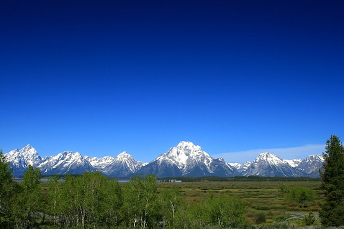
Gardiner River

1G3 and 1G4 provide a pair of sites that work well for a group. You can put two eight-person crews here, within an easy walk of one another. Unfortunately, neither of these sites have a view of Electric Peak. However, either one would make a good basecamp for a climb of Electric.

Electric Peak
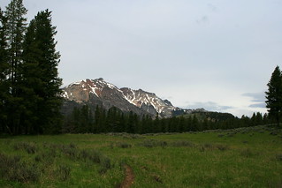
1G4. This site is close to the Gardiner River water source. This site is very open with a big fire circle that is great for a group. The campfire has very good views across the meadow and into the lower portions of the Gallatins. Even though this site is visible from the trail, I’d choose this one over 1G3 if I were backpacking by myself.

1G3. This is a more closed-in site. It is much more private than 1G4, located some distance off the trail. It does not have any real view from the cooking area or tent sites. It’s about a hundred yards to the river water source.

Gardner's Hole1G2. This site is also on the Gardiner River, but it’s on a different trail than 1G3 and 1G4. You can’t accommodate 16 people here. Schneider gives this site five stars, but I can’t figure out why. He likes it as a private site with a good view, tent sites, and water source. I certainly agree on the tent sites and water source, but there were no real views from the site. You can get some good views if you walk upslope a bit from the sites (no trail), but hte sites are in the woods by the river.

The nearby site 1G5 is for stock groups only, but it better fits Schneider’s review. It’s possible that he mixed up the two sites in his notes. For views similar to mine, see http://www.trailguidesyellowstone.com/yellowstone_hikes/fawn_pass_trail_east_yellowstone.php
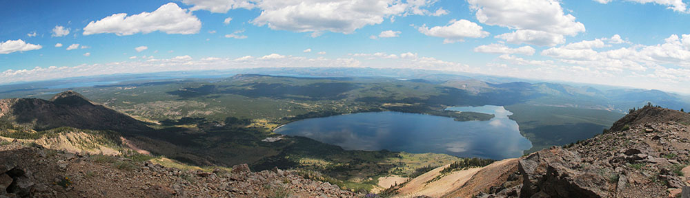
Grebe Lake

There are three sites on the north side of Grebe Lake that would work well for groups. We used 4G3 and 4G4, but 4G5 would also pair well with 4G4. 4G3 and 4G4 are a little farther apart than I’d like for a group, and the trail between them is indistinct. The lake was very buggy in late June, and the area mostly seems to attract anglers. All three sites had clear views of 4G2 on the other side of the lake, which was also occupied. This reduces the privacy.Guard uinta

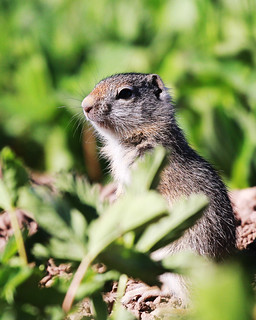
4G3 parallels the trail. It has beautiful views of the lake but is not at all private. The tent site, bear pole, and eating area are spread out in a line and more separate from one another than is true at most Yellowstone backcountry sites. There’s a community of Uinta ground squirrels between the campsite and the lake.

4G4 is a real winner, though the bear pole, eating area, and tent sites are closer together than they should be. The site is hidden in the woods but looks out over the lake.
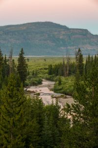
Snake River

8C1. I love the views from this site, which go up and down the Snake River Valley. The bear pole, eating area, and tent sites line up parallel to the trail, reasonably spaced out but nowhere near the official recommendations. Because we don’t make campfires, we ate away from camp on bluffs overlooking the river. You don’t have any privacy, and the trail attracts a fair number of horsepacking groups on their way to sites on the national forest.
Snake River MorningThere are other sites within a reasonable distance that would make this work for a group. They’re a little farther apart than I’d like, though.

Thermal features flow into the Snake River in this area, creating one legal (and safe) soaking area next to the river. You should be aware of the risk of the Naegleri fowleri parasite, which is deadly.

Basin Creek

8B1. This site has been moved since Schneider wrote his book, and the nearby trail junction has been restructured a bit so that the site is south of the junction and not north as the maps show. Signage was not yet adequate when we were there.

Schneider calls it “semiprivate,” but it’s now a very private site. Because it’s new, it lacks a defined spur trail. If you’re coming from Snake River, look for the sign and walk uphill across the meadow. You’ll find the site in the woods. If you’re coming up the Basin Creek Cutoff Trail, turn left at the junction with Heart Lake, not right. (The NPS failed to tell us this; you might ask for details at the backcountry office.)
Basin Creek Sunrise
Inexplicably, the cooking area, bear pole, and best tent site are all on top of one another, so don’t use that tent site. It’s hard to find level sites in the woods, so we just found a hard site in the meadow. The meadow has quite a few bison wallows, and I wouldn’t use those! As campers have explored the site since we visited, you might find some tent pads at the edge of the woods looking over the meadow There are great views toward Overlook Mountain from that meadow, so enjoy.

Heart Lake

There are five campsites on the west side of Heart Lake. 8H2 and 8H3 share a new spur trail, but are otherwise private. We could see 8H2 from our bear pole, but the campers there never showed any awareness of us. Both sites are on the lake and allow campfires. 8H2 has a composting pit toilet with no walls. It’s visible from the cooking area, which is another example of poor landscape design by the NPS. However, we never had any problems with smells.
Heart Lake sunset
We only found one good tent site at 8H3. It has a good view of Mount Sheridan, but not of Heart Lake. However, there is a shoreline area along the lake where we watched sunrises, sunsets, and beavers.

All of the Heart Lake sites are great basecamps for a hike up Mount Sheridan. That’s a nine-mile round trip from 8H2 and 8H3, a little less from 8H4-8H5-8H6, and at least a mile more from 8H1.

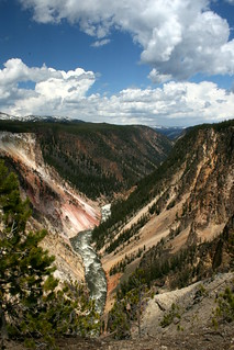
Thorofare and Southeast Arm

Park Point offers a group of three sites and a trailside pit toilet. Two of those sites, Park Point North (5E8) and Park Point South (5E9), have beautiful locations along the lake. Their meadows are also mosquito-breeding facilities, a feature you’ll notice if there is no lake off the breeze. The third site (5E7) is back from the lake, in a marshy area that has a ferocious mosquito population and no views. Avoid that one.

Three miles further south you’ll find Columbine Meadow (5E6), a lovely spot where I have had lunch but never stayed. This is nine miles from the trailhead, so it gives you the mileage you need for your first (or last) day on the trail to the Thorofare Ranger Station.

5E4 Brimstone Bay is a lovely lakeside side with a beautiful view of Yellowstone Lake and Promontory Point, down an easy 0.2 mile spur from the trail.  It rightly earns five stars from Schneider. My only concern in August 2017 was that there were a lot of snags in and around the campsite – one fell down during our dinner on a perfectly calm day. While the park had cleaned up those by July 2022, my students found new widowmakers. Place your tent well.

The Beaverdam Creek area has two campsites some distance apart, and my old map shows that both of them have been moved. Beaverdam Creek 5E1 is west of the trail, on a spur that will take you a few hundred yards away from the junction – and your water source at the Beaverdam Creek ford.  The tent sites are squeezed into a narrow space between a steep slope and the forest, but the views are fantastic. It’s a long way to water, though.

6B4 Beaverdam Meadow seems to have new routing when we were there in 2017, with about half the 0.4 mile spur trail essentially guesswork through a meadow.  That meadow seems popular with horse parties, and we saw a lot of, uh, horse sign there in 2017.  Horse sign was much less in 2022 and 2023. The food area and tent sites don’t have views. It’s a short walk to the creek, with constricted views of the mountains but lots of privacy. This site is the approximate location of one of the 1870 Washburn-Langford-Doane Expedition’s campsites, and still gives a group lots of room.

6C2 River’s Edge is a beautiful site on a bluff above the Yellowstone River with a number of good tent sites.  When the river is high (as in 2017), it was challenging to get down the bluff to water. Unless you’re on horse, the mile-long spur trail entails some route finding to cross streams in the meadow and to reach the well-marked campsite.

6D3 surprised me. It’s on a small triangle of land between braids of Mountain Creek, barely hiding out of view from the trail. If other hikers or, say, a bull bison are using the ford, you’ll see them if you step ten feet from the cooking area. The sunset views were glorious to both the west and the east, as the warm light hit the Absarokas. Schneider only gives it three stars because it’s not exactly private, though traffic is so light on the Thorofare Trail that I don’t think that’s a problem. I’d give it five stars for space, “swimming” hole, and views. The only downside is that, no matter which way you’re traveling, you start your morning with a ford. Brrr!

6Y6 Three Mile Bend on the Yellowstone River has a beautiful view and a lot of mosquitoes. This was the only place we used our head net in 2017.  Most of the group used head nets in 2022, though I didn’t. The mosquitoes were better behaved in 2023, and don’t remember anyone using the head nets both nights. It’s easier to get down the bluff for water than it is at 6C2, but there was no flat space at the river’s edge in 2017 – we were balancing on slick mud. In 2022 and 2023, water levels were lower and we had a nice beach downstream from the camp. The spur trail required some bushwhacking through the willow, but the route finding is easy if you stay close to the river.  (Horse parties will want to stay away from the river and look for a gap in the woods to the left once the river is no longer visible.) There was a lot of bear sign there in 2017, and we met someone who had a grizz examine her bag at the food pole two days before. We heard wolves both nights in 2022 and 2023, with fresh wolf and elk prints the first morning.

6Y5 Cliff Creek. I have not been to the actual campsite, but it clearly lies inside a stand of trees downhill from the trail and at the edge of a wetland. Some parts of the site are visible from the trail. Looking up, Cliff Creek descends between two arms of The Trident, and supposedly you can scramble to the falls. I had reserved this site in 2022 but the bear pole was damaged in the June storms so the NPS rerouted us. Next time.
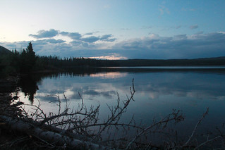
Shoshone Lake

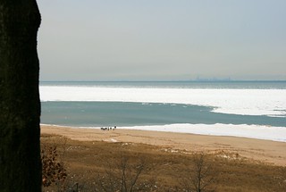
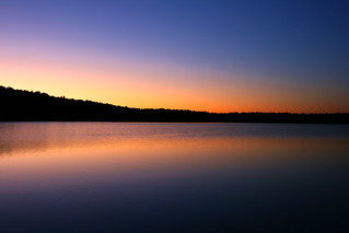
8S0 and 8S1 are two campsites next to each other, both next to the Shoshone Lake Ranger Cabin.  The paddler site is just back from the lake, with the lovely beach you see here. I had lunch here before exploring the eastern shore. The backpacker site is back from the lake and right next to the trail, with a terrible pit toilet. The two sites seem to have been classified as one in Schneider’s book, and he gives the paddler site four stars.

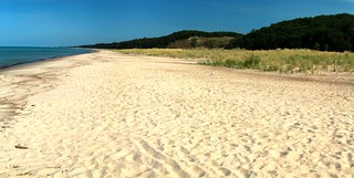
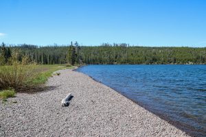
8S1. The backpacker’s site is further inland, near the trail junctions. The backpackers’ site has peek-a-boo views of the lake. It’s an easy walk down to the beach, offering great views of beautiful Shoshone Lake. As you can see in the photo, the backpackers’ site is serviceable but unexceptional. The outhouse has reached that stage (in 2022) where screws and nails no longer hold everything together, so gravity makes those decisions.

8S2. I didn’t stay here but walked through the middle of it, and talked to someone staying there. There’s a tent spot about 10-15 yards of the trail but the cooking area is right on the tail, with the lake on the other side of the trail. Pretty but not private.

8S3. This was empty when I walked through it, but is similar to 8S3 with perhaps a little more privacy.

8R5. This is a gorgeous site well off the trail. The bear pole and cooking area are on a small bluff above the lake. You could also bring your food down to the shoreline for views of the Shoshone Geyser Basin and Shoshone Lake.  The site lies down a good spur trail, about a half-mile from the trail. There’s a pit toilet (no walls) and abundant tent sites, all an appropriate distance from the cooking area and each other. The shoreline offers great sunrise and sunset views in September. The site is very private unless you’re on the shoreline and a canoe goes by on the way the geyser basin.

Herbert Hoover’s Heroic History

Stanford_University_Hoover_TowerI’ve always had a soft spot in my heart for Herbert Hoover. I had the opportunity in college to do some research in the Hoover archives as part of a senior thesis. Though his presidency was not a success, there is much to admire in the rest of his life, both public and private.

When I moved to the Midwest, I was able to visit his birthplace in West Branch, Iowa. It’s a national historic site, managed by the National Park Service (NPS). The site preserves about a dozen historic buildings to give you a sense of what it was like for Hoover to grow up here. Next door you’ll find his presidential library, managed by the National Archives and Records Administration. Taken together, these two sites are an Iowa gem, well worth a visit – and convenient, just off Interstate 80, east of Iowa City.

Though I like the site, it tends to present President Hoover’s self-image more than his actual history. Following Hoover’s self-image, the National Park Service here interprets its subject as the ultimate American success story — orphaned at age ten, a boy from small-town Iowa succeeds through education, hard work, and faith. After becoming a millionaire by age 40, the story goes, he turns to public service and eventually reaches the presidency.


Herbert Hoover Birthplace

There’s a lot of truth in that story. Even so, a critical perspective requires that we look more fully at the political setting of this national historic site and the stories it tells. The site’s history begins just after Hoover was elected President in 1928. People began to visit West Branch, and Hoover’s wife, Lou Henry Hoover, wanted to provide something to celebrate her husband’s achievements. After exploring several options, the Hoover family bought his birth home in 1935 and began to restore it. They worked with a private group in which Herbert’s son Allan played an important role. That group operated the site as a memorial and public park, following the family’s wishes for the site, until Congress made it a national historic site in 1972.

Herbert Hoover was involved in planning this site over these years. That legacy shapes park planning today. For example, two of the five “fundamental resources and values” reflect Herbert Hoover’s own decisions, the gravesite location and its vista over the birthplace cottage. President Hoover chose that vista to show “that anyone can start from a simple life and achieve great things”

Hoover's Fences

Interpretation throughout the site emphasizes Hoover’s view of himself and his personal history. Hoover believed strongly that America provided great opportunities for the self-made man. A central theme found in several locations is Hoover’s statement that,
“My country owes me nothing. It gave me, as it gives every boy and girl, a chance . . . In no other land could a boy from a country village, without inheritance or influential friends, look forward with unbounded hope.”

The NPS continues that theme. It invites visitors to “discover how family, faith, education, and hard work opened a world of opportunity—even the presidency—to a man of simple beginnings.” It claims that “Hoover exemplified the ideal of individualism and the self-made man. His expertise as a mining engineer made him a millionaire by age 40. Having been raised in the Quaker traditions of being humane and generous to others, Hoover embarked on a course of public service for the rest of his life.”

Hoover certainly came a long way, but his was not exactly the rags-to-riches story of a man who accomplishes everything on his own. While he was not born to wealth like Theodore Roosevelt, neither was not born in a frontier cabin like Abraham Lincoln. For that matter, he also was not born to freedmen in the Reconstruction South. He was born to successful parents in a very small single-family home in a growing community of about 500 people.

The chains I forged in life

His father, Jesse Hoover, owned a blacksmith business. That business outperformed competing smithies in town, a a uccess that the NPS attributes to “Jesse’s friendliness, honesty, and strong work ethic.” As his income grew, Jesse Hoover sold his blacksmith shop and bought a more lucrative farm implements business. This earned enough money to move the family to a much larger house up the hill, the boyhood home that “Bertie” Hoover remembers.

Whetstone and gear

The family’s financial success was short-lived. Jesse Hoover died when Bertie was six, and his mother died four years later. Their three children were divided among relatives. However, Bertie was fortunate to live in a supportive community of Quakers in which his mother Hulda Hoover had been a religious leader. Several relatives, and even his schoolteacher, offered to take him. After a year with local relatives, Hoover’s family decided to send him to Oregon to live with a successful uncle, Dr. Henry John Minthorn.

Though he was an orphan, Bertie had financial resources. His mother had saved $850 from Jesse’s insurance policy for Bert to go to college. That was a sizeable sum in the 1890s, equivalent to perhaps $20,000 today. A recruiter for the brand-new Stanford University contacted Dr. Milton and successfully recruited his ward. First-year tuition at Stanford was free. With his mother’s nest egg as a base, Hoover worked to cover his other costs.

Hoover earned a geology degree and went to work immediately as a mining engineer in California’s gold mines. His work later took him to Australia, China, and Europe, where he worked as a consultant. While working at his consulting firm in London, Hoover helped Americans return to Europe when the Great War broke out in 1914. After this success, people invited him to organize relief for Belgium, a neutral country that had become a major battleground when the Germans invaded. Reflecting his Quaker beliefs in service to community, Hoover answered the call.

His relief work was a great success, expanding throughout Europe. He even provided food relief to both sides in the Russian Civil War. These successes catapulted Hoover into the public eye. Though some wanted him to run for president in 1920, he ended up serving both Harding and Coolidge as Secretary of Commerce. Success in that role made him a successful presidential candidate in 1928.

That story certainly provides the material for Hoover’s view of his own success. He did indeed rise from a small town to the presidency through hard work, education, and faith. Even so, that self-image downplays the helping hands he received. His father was a successful small businessman, as were others in his family. That family came to the rescue when his parents died. His inheritance helped him through college, as did the generosity of Jane and Leland Stanford in building their university.

Friends meeting house

The town of West Branch also provided Hoover with a lot of social capital. It had been settled mostly by the Society of Friends, as the Quakers are formally known. Hoover’s extended family was part of the early group who built West Branch, and civic leaders. The Quaker community instilled him with the values that served him well, “education, thrift, and individual enterprise.”

In addition to teaching visitors about the Quakers at Hoover NHS, the NPS idealizes Iowa small-town life. The interpretive plan says that “The park presents the opportunity for visitors to experience the serenity of the landscape and explore the simplicity of the small town rural character with all of their senses.” This simplicity helps illustrate Quaker values of simplicity as well.

P. T. Smith House

However, small-town life here was less bucolic than the NPS imagines. Those who explore the entire website will find stories about ten houses in the historic district (the Garvin, Hayhurst, Leech, Mackey, Miles, C. E. Smith, P. T. Smith, Staples, Varney, and Wright homes). Many coincided with Hoover’s days in West Branch, but several were built after he had moved to Oregon. The house histories on the website mention that three of these homes went through foreclosure, the Hayhurst (1878), Garvin (1885), and Leech (1886) homes. The park does not say this, but those years coincided with a national decline in per capita income in the 1880s, a decline associated with the Great Depression of 1873-96.

The financial traumas that must have been associated with these foreclosed mortgages provide a view of American capitalism that differs considerably from what the NPS presents at the site. This was not merely a community that valued education, hard work, and faith, but a community where some hard-working people lost their homes to the local bank or real estate developer. These frequent foreclosures — three of the ten historic homes in eight years — contrasts with Hoover’s memory that “In consequence of plain living and hard work, poverty has never been their lot.”

A more realistic sense of how West Branch connects to the national and global economies might make for some good story opportunities. The park brochure notes that Hoover’s ideals of individualism and charity pointed in different directions during the Great Depression. It might go further and explore how his town’s economic difficulties shaped both of those values. As we now know, those values were a poor guide to policy-making in Hoover’s presidency.

Hoover’s failure to address the Depression paved the way for Franklin Roosevelt’s New Deal, with large-scale government intervention in the economy far beyond what Hoover was willing to do. That set the stage for the great debates of the twentieth century, with presidents such as Lyndon Johnson expanding the role of government while Ronald Reagan and others sought to decrease it. Interestingly, Hoover later found a role in the expansion of government. He led two “Hoover Commissions” on making the executive branch run more efficiently, one for Truman and one for Eisenhower. However, the park does not connect this fact to any larger issues in American history.

The park’s current Long-Range Interpretation Plan intends to make the Depression of 1929-39 a bit more visible than it currently is. Those recommendations were not yet visible on-site in 2012, though the adjacent Presidential Library does not shy away from the Depression years.

Because the Hoover family played a major role in establishing the national historic site, interpretation here stays close to his own self-image. That story belongs here, but it should also connect to larger and more complicated stories about the political economy of small-town America.

Adapted from “Telling America’s Stories,” a book manuscript by Robert Pahre. For questions and comments, email him at pahre@illinois.edu

Visit Herbert Hoover NHS


A House Divided at Ulysses S. Grant NHS

24-pound howitzers at Grant

The Civil War battlefields in the National Park System have long emphasized battlefield tactics and heroism. They are decorated with stately cannon, and it’s hard to imagine the blood and noise of the battlefield. Until recently, most of them have also skirted around the big issue: why were these men fighting in the first place?


The answer, briefly put, is slavery. Southerners have resisted that conclusion, and Civil War buffs in the South have fought NPS staff at those sites that have taken the issue on. Interpretation is changing – for example, Chickamauga has a good exhibit on how slavery caused the war, though it’s shoehorned into a hallway. Among the battlefields I’ve visited in recent years, Pea Ridge and Murfreesboro address slavery, while Wilson’s Creek and Glorieta Pass (Pecos) do not.

Visitor Center

One of the best interpretations of slavery in the Civil War appears not at a battlefield, but at Ulysses S. Grant NHS in a suburb of St. Louis. Slavery plays a major role in interpretation throughout the site. The brochure calls White Haven as “A Microcosm of National Issues” because it divided Grant from his in-laws, who owned the White Haven farm here.

Family Photos

His father-in-law, “Colonel” Dent was a slaveholder who favored secession. Grant’s father, Jesse Grant, was a strong opponent of slavery who refused to visit his son at White Haven. Julia’s brother Fred, a long-time friend of Ulysses, fought with the Union. However, John Dent, Fred and Julia’s brother, fought for the Confederacy.

Enslaved people work the farm

The website gives a page to slavery, discussing the economics and demographics of the institution in Missouri. Visitors to the farm will find the same information throughout the house and grounds. Aside from the plantations of the “Little Dixie” region along the Missouri River and the “Bootheel” region in the southeast, most of Missouri did not have many slaves. White Haven’s ten slaves made it unusual in the St. Louis region, whose enslaved population was in steady decline. This reflected a change in farm economy, as farming switched from large-scale plantations using slaves to grow cash crops to small-scale truck farms growing fresh produce for the urban market.

The NPS has given the enslaved people of White Haven an opportunity to tell their stories, notably the cook Mary Robinson. Her later recollections enrich interpretation throughout the site, including details of the kitchen work. Visitors will learn that some of the enslaved staff here could read and write, though both pursuits were illegal under Missouri law. Slate pencils found in the winter kitchen provide evidence of literacy.

The house at White Haven

Julia’s puzzlement at one slave’s “carelessness” also provides a window into how the enslaved workers evaded her oversight. “Old Bob” was responsible for keeping the fires going in the seven fireplaces of White Haven. When the embers died out, he had to walk a mile to the neighbors “and bring home a brand of fire from their backlog.” Obviously, this gave him some free time away from the Dents, and an opportunity to socialize at a neighboring farm. The enslaved staff also used to bring Julia special gifts so that she would intercede with her parents to allow them to travel to visit their wives on nearby farms.

Grant and Dent argue slavery before Mary Robinson. (This exhibit has since been changed.)

The NPS points out that Julia Dent seemed oblivious to other realities, thinking that the “house kept itself” and that the family “produced” the crops on the farm. She later wrote that she believed they were happy, at least before “the Rebellion.”

Ulysses had a better sense of the material conditions of slavery. Presumably this understanding played some role when he remodeled the kitchen after the war, providing modern appliances and inside passageways from the kitchen.

Reality struck home when the Union gained control of neutral Missouri early in the Civil War. Colonel Dent avoided St. Louis, now dominated by Unionists, and became estranged from many of his neighbors. His slaves saw opportunity and began to run away, demonstrating by their actions just what they thought of their master and his home.

Ulysses S. Grant National Historic Site does a good job interpreting the realities of slavery in this part of Missouri, and shows how other the Civil War battlefields might take a more realistic look at what the Civil War was really about.

Grant’s barn, now museum

This is part of my book manuscript, Telling America’s Stories: How the National Parks Tell the Stories of Westward Expansion, in progress.

More photos in my Flickr album.

Official NPS site

An Experiential Quasi-Experiment

Audrey Neville and I will be conducting a quasi-experiment next semester in my lecture course on environmental politics. Students can decide to go on a field trip with me to Indiana Dunes National Lakeshore. If they prefer, they can go on an online “virtual field trip” to the same place. Either way, they will complete the same assignments – some quiz-like questions along the way, some discussion, and a take-home essay at the end.

We’re interested in how the physicality of experiential learning affects learning outcomes. I won’t go into our expectations here, but they follow in a straightforward way from the literature on experiential learning. Some earlier work with Carie Steele has evaluated field experiences in a non-experimental way. Audrey and I see this second project as a quasi-experiment in which we compare two modes of learning. It’s important to note that we do not compare either learning mode to a null (no field trip), but only against one another.

The field trip is embedded in a larger course, and presents material equal to about 1.5-2 weeks in that course. All students engage in an online learning activity (OLA) that introduces key analytics and concepts relevant to the field trip. The unit focuses on the relations of humans and nature in the abstract, drawing from issues you may know from William Cronon’s Uncommon Ground. Then we apply those issues to the concrete landscape of Northwest Indiana, where a national park unit coexists with three steel mills, two power plants, the Port of Indiana, two US highways, three interstates, and a mix of communities that range from second homes for the wealthy to the post-industrial cities of Gary and Hammond.

The physical field trip lasts an entire Saturday, about 11-12 hours from door to door. About half of that experience is driving. Our target is to make the virtual field trip take about 5-6 hours, though it’s possible that students can work through it a bit faster. The virtual field trip has quite a bit of video, taken on a pseudo field trip in September with three Illinois students acting as stand-ins for the virtual students. This was the third time I’ve taken students to Indiana Dunes, so my “shticks” are pretty stable.

We designed the OLA and the two field trips with the experiment in mind, but we did not design them to serve the experiment. The material serves pre-existing learning objectives in the course. We followed several principles in our OLA and field trip designs, and these principles affect the quasi-experiment.


Autonomy. Students choose their own experience, based on their own interests and commitments. We do not randomly assign them to either. (Random assignment would also introduce some injustices that we want to avoid.) We expect some differences in the two student populations, and we will have to control for those differences instead of getting rid of them through random assignment.

Access. All students should have access to whatever modes help them learn best. Following the conventions of experimental design would require a control group of students who would not be allowed to access either field trip. These conventions would undermine pedagogical principles of access. We will thus use a nonequivalent groups design to examine how the treatments affect student learning. Though an experimental design would have better internal validity, it seems strange to sacrifice student learning in pursuit of greater understanding of student learning.


Student learning first. We want both options to provide great learning experiences, and we’re not going to sacrifice learning in either option to make the other option look better. If we need to make tradeoffs between the purity of the experiment and pedagogy, pedagogy will always triumph.


For this reason, we allow students who take the physical field trip to view the virtual field trip if they like. We will also provide students who take the virtual field trip with enough information to drive up to Indiana Dunes on their own and obtain a physical experience. We want students to be able to do whatever they want to do in order to succeed in the course. We realize that this is not ideal in terms of experimental design, and we’ll have to control for any students who do this.

Neutrality. We want the physical and virtual field trips to be as similar as we can make them. We want both to be successful learning experiences. Students may mention things that they “saw” without revealing whether it was virtual or physical. their choice. We should not know whether a student chose the virtual or physical field trip, and will grade without that information.


Online learning is popular among administrators and some faculty, controversial among other faculty. People usually contrast online learning with classroom learning, whether lectures or seminars. However, advocates of experiential learning believe that it provides much better learning outcomes. I teach across all three “platforms,” and want to understand better what each platform does best.

Thank you for reading so far. We would be grateful for your comments and reactions as we finalize our course design and research design.

Bailly Beach


Yellowstone 2013 – The Grand Tetons

Emma Matilda Lake

In previous years, we have started class in Grand Teton National Park.  We often have students who choose to fly, so we pick them up at the Jackson airport. Being further south than Yellowstone, GTNP is also a little bit closer to Illinois, and we can cover the 1350 miles in two days.


Dependable moose

Seeing the Tetons first can shape students’ views of Yellowstone in negative ways.  For many students, Yellowstone can be a bit of a disappointment, as they decide that they like the spectacular scenery of the Tetons more. Jackson Hole also has a more visible elk population, which shapes students’ perceptions of the landscape.  Wildlife such as moose is more dependably visible on Teton trails.

The Tetons are hard to beat

Interestingly, seeing Yellowstone first in 2013 produced the same result – the Tetons show better.  The reasons varied a little. Students preferred the scenery in the Tetons to that in Yellowstone. Students preferred the feel of Teton trails over the boardwalks and greater development of Yellowstone’s trails, even in the backcountry.

Making bad choices?

Students also though that the Tetons attracted “higher quality” hikers, even on the very popular trail to Inspiration Point. It’s been interesting to me that “lower quality” hikers (unprepared in clothing, supplies and demeanor) make my students view a trail as more like developed frontcountry.

This year’s wildlife viewing was not noticeably better in either park. We did not see pronghorns in either park, though we saw many outside the parks. We did not see moose, wolves or bighorn. We did see some smaller species for the first time in my classes, notably badger and pika. Yet even without wildlife sightings, students preferred the Tetons.


Tetons at Dawn

Is there something wrong with Yellowstone? You can’t do much about the scenery.  The Tetons are one of the world’s great mountain ranges in scenic terms. Yellowstone has the Absaroka, Beartooth, Gallatin, Red, and Washburn ranges — all beautiful but they do not match the Tetons. Spectacular as Yellowstone Lake is, Jackson Lake has the better setting.

Far from the madding crowd

More important than the scenery, the visitor experience in Yellowstone clearly impacts the students’ own visitor experiences in undesirable ways.  Visitors are more likely to seem ill-prepared in Yellowstone, are more likely to stick to the parking lots, and seem to crowd the wildlife more. That makes Yellowstone seem less natural, even less “wild.”

Better without people?

Sadly, in the world’s first national park, visitors can be a problem for other visitors.


Fuzzy Wilderness

Evidence of human presence in a state wilderness area.

Wilderness law encourages us to draw a sharp line between “wilderness” and “not wilderness.”  That’s certainly easy for land managers because it tells them how to manage specific lands on either side of a line.  It’s supported by the natural science approach to most land management, which thinks in terms of physical characteristics of a place.

Loon Lake, Sylvania Wilderness

A wilderness is “untrammeled,” without evidence of human occupation or resource use.  (Evidence of recreational trammeling is, perhaps incoherently, consistent with a this definition of legal wilderness.)


Not a legal wilderness, but it seemed wild.

Humanists might suggest that “wilderness” is socially constructed. Society has built an idea of wilderness in general, and associates certain kinds of places with that idea. As I know from conversations with students, those ideas are widely held but also somewhat malleable. Students are willing to consider types of wilderness they hadn’t thought of before, like caves, underwater sites, or tallgrass prairie. They also change their minds about what signs of human presence they will accept.


Politics of Yellowstone

Workbooks and such

As is usually true, social scientists tend to take positions straddling the views of humanists and natural scientists.  Through surveys, logs and journals, poking hikers randomly for their feelings, and other techniques, social scientists have connected physical places to social constructions of those places.  I do this informally while teaching, drawing from the wilderness literature to define the kinds of questions I ask. Students fill out worksheets that look like some of the surveys, and I control the places where I have them fill them out.

Bear viewing on the trail

Based on some of these techniques, Carie Steele (Texas Tech) and I have examined how our students have constructed the idea of “wilderness” in the field. In a recent article, “What Makes it Wild?”, we discuss two different ways that perceptions of wilderness change independent of the landscape. First, the sequence of wildlife sightings matters: seeing elk and then a bear along a trail is different than seeing a bear and then an elk along the same trail. Seeing the bear first makes the trail seem wild, which makes the elk seem wilder too; seeing the elk first would not make the trail seem wild. Bison, wolves, and even spawning trout can make a place seem wilder.

Using social media to construct “wilderness”

Second, a group may define wildlife and wilderness in idiosyncratic ways. This makes one group perceive a place differently than other groups do, just because of the peculiar direction their own conversations have gone.

The Yellowstone River is wild here.

If “wilderness” is socially constructed, if it changes, if people view it differently, if different groups arrive at different construction, then we probably should not think of wilderness in terms of sharp lines. If our definitions of wilderness are degrees of gray, instead of being black and white, how should we manage wild places? How do we keep it wild if “wild” is a gray area to begin with?


The 1964 Wilderness allows grazing.

These constructions have real consequences for land management.  For example, the National Park Service wants to remove a sustainable oyster farm from a wilderness area in Point Reyes National Seashore because it’s incompatible with “wilderness.” Defenders of the oyster farm, including some wilderness theorists, disagree. They believe some kinds of resource use are compatible with “wilderness.”

Does a fuzzy wilderness have oyster farms?


For the Point Reyes issue, Google “Drakes Estero.” You’ll see links to both sides.

Pahre, Robert and Carie Steele. 2013. “What Makes it Wild? Visitors’ Constructions of Wildlife and Wilderness in the Greater Yellowstone Area.” International Journal of Wilderness 19(3): 25-31 (December). Available here in an on-screen reader at the IJW website.

Some photos of wilderness.

Autumn in the Dunes

Entrance to Portage Lakefront Unit

In early November, I took a group of students from my “Environmental Politics” class on a field trip to Indiana Dunes National Lakeshore.  A few of them knew the dunes as a good place to go to the beach – but that wasn’t our agenda on a windy November day.

Midwest Steel from Portage Lakefront

We started at the Portage Lakefront Unit to talk about the political history of the region.  From the breakwater, you can see the full sweep of the Lake Michigan shoreline from Michigan City, Indiana, to Chicago.  We couldn’t quite see Chicago, but the industry of East Chicago, Whiting, Gary, and Hammond were all visible.


At this spot, the park faces a steel mill across the channel of Burns Ditch.  The Port of Indiana and a NIPSCO power plant, both of which serve the mill, are barely visible on the other side of the factory.  The town of Ogden Dunes lies on the other side of the park, a well-to-do community that benefits from the protected landscape of the national park.

Dunes and Industry

The political geography of national parks is nowhere more visible than here. Indiana Dunes National Lakeshore owes its existence to a political compromise in 1963.  Dune advocates accepted a subsidized harbor bill while industrialists acquiesced in creation of a national park unit here.  Each got the core of what they wanted, while each had to accept the existence of the other next door.

NIPSCO from Bailly Beach

The geography of Portage Lakefront makes this compromise visible, and always sparks a conversation. How can nature and humans coexist? What are the benefits, and what are the costs? Seeing a national park, residential community, and major industry lying cheek-and-jowl shows students what these issues look like on the physical landscape.


Cowles Bog Trail

After Portage Lakefront, we explored the natural landscape that the park preserves. The best place to do this is the Cowles Bog Trail.  The trail begins by walking along Cowles Bog, a National Historic Landmark that recognizes where Henry Chandler Cowles (1869-1939) pioneered the study of ecology. The swamp forest here includes pin oak, red maple, and yellow birch. Some of these trees are moving into the swamp and transforming it.  In one stretch, the NPS kills these trees by girdling them, to halt this natural process of ecological succession. The park honors Cowles’ studies of ecological succession by arresting this process in time, thereby displaying it better in space – keeping both the fen and the swamp forest.


The final dune

As we climb into the dunes, we gradually see more habitats, including oak savanna with black and white oaks and shrubs such as chokecherry, witch hazel and sumac. We pass some ponds behind the dunes, and then finally arrive at the foredunes above Lake Michigan.  On top of the dunes we see various hardwoods that have established themselves.  They can move in here because the marram grass near the beach has stabilized the soil and transformed the ecosystem, providing a place for cottonwood, oak, hickory, and white ash to move in.

Root and Leaf

These diverse microhabitats characterize Indiana Dunes, and explain why this small place holds more than one thousand plant species. Congress preserved not only recreational opportunities on the beach and trails but also a hotspot of biodiversity.  Microhabitats are scattered among towns, factories and transportation networks – a microcosm of the wider problem of environmental politics today.

Park Pavilion and Steel Mill

Can we preserve natural places and a full range of biodiversity in a landscape dominated by humans? Does preserving our natural heritage require killing native trees? While they enjoyed getting out of Champaign-Urbana for the day, we also left them with some questions for their reflective essays on the trip.


Additional links and resources

For four seasons in Indiana Dunes, see my Flickr set.

For my essay comparing Indiana Dunes with Michigan’s Sleeping Bear Dunes, see the National Park Traveler.

For my photo essay on the Midwest’s national park units, see Illinois Issues.

Official site for the Indiana Dunes.