Campsites in the Charles C. Deam Wilderness, Hoosier National Forest
The Deam Wilderness lies about 20 minutes southeast of Bloomington, Indiana, across Monroe Lake. It’s small by western wilderness standards, with only 13,000 acres. Websites and US Forest Service signs don’t provide much information about the campsites, including important details such as “is there water there?” This page should fill the gap.

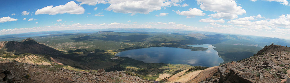
Backpacking on the Peninsula Trail
The USFS has posted a helpful brochure on the internet here.
Page 1 has the camping regulations, while page 2 has a map of the wilderness showing the trails and campsites. Designated campsites have numbers on the map and most have signs identifying them in the field, though not always with the number. If you can read a map, you’ll be fine.
National Geographic’s Trails Illustrated Map of Hoosier National Forest provides greater detail and multi-color readability. The Deam takes up one side of the map.
I have camped at several of the sites reviewed here, visited a few more out of curiosity, and have seen most of the rest from the trail. I’ve noted the quality of information below.
Note: I mostly visit the Deam in spring and fall. Streams might not be a good source of water in late summer. Water quality in ponds probably goes down as summer drags on. Monroe Lake lies behind a dam and always has water.
Sycamore Loop Group

Kobuk on the Sycamore Loop
The Sycamore Loop is 4.7 miles in length. The south side of the loop sticks to a stream before ascending to a ridge for the north side of the loop. It would make an attractive day hike. That hike would be about 6.2 miles, closing the loop on the west side and adding the connector to the trailhead. Campsites 1-4 are all on the south side of the loop.
Campsite 1 seems to refer to the campsite at the junction of the Terrill Ridge Trail and the Sycamore Loop Trail. It’s close to the parking lot, visible from both trails, and lacks water. If you’re just looking to camp without any cars around, that’s your site. It’s close enough to haul an ice chest, lawn chairs, firewood, and other things I leave in the car.
If you go down the Sycamore Loop Trail, you’ll hit an unmarked campsite near a creek at the bottom of the hill, tolerably close to where the map shows campsite 1. (I have not seen a numbered sign at either place.) There are flat spots there that would meet the requirement of being 100 feet from the trail and 100 feet from water. It’s a lovely site, within view of both stream and trail. If this is campsite 1, leave the ice chest and lawn chairs in the car.
Campsites 2, 3, and 4 are similar to that last site. Each has good water from the creek, flat tent sites, and fire pits. Each is visible from the trail, though campsite 3 is less visible than the others. They are not particularly private, but most campsites in the Deam are not.
Campsite 5 sits next to a beautiful little pond. The current trail runs on the opposite side of the old horse trail, so you have a little distance from hikers. There is less flat space here than at other sites, so I wouldn’t plan to put a big group here. There’s vegetation all along the shore, so there’s a minor bother to get to the pond, and the views aren’t as nice as campsite 6 has of its pond.
Terrill Ridge Group

Pond at Terrill Ridge
This group lies atop Terrill Ridge, which has access on a wide, well-graded trail that seems like a former road or wagon route. Where the trail turns left to a cemetery, there’s a little trail off the right that’s marked “no horses.” That narrow, winding trail gives you trail access to the sites. (Some are better reached by water.)
Campsite 6 sits on a beautiful pond. Depending on your definition of “site,” there are 2-4 around the lake, as well as one behind a berm with good access to the pond. This was a popular day hike destination when I camped there, so there was quite a bit of traffic. The best site for a lake view is also the least private.
The (unmaintained) trail continues along Terrill Ridge. There are several spots you might camp, all of which meet the USFS requirements for undesignated campsites. The end of the ridge was the most attractive, with peekaboo views of Monroe Lake. None of them have water.
The end of the ridge would seem to have access down a steep hillside to campsites 7 and 8. I haven’t tried that, so it’s just a guess.

A crossing of Axsom Branch
I have not seen campsite 9, accessed by foot from the bend in the Axsom Branch Trail. I should note that campsites 7, 8, and 9 presumably appeal to boaters and not backpackers.
Grubb Ridge Group

Kodiak guarding the tent at a Grubb Ridge site.
This is a small group of campsites at or near the junction of the Grubb Trail and the Peninsula Trail. They’re only 2.5-3.0 miles from the Grubb Ridge Trailhead.
Campsite 12 sits right next to the junction, so it’s not at all private. There is also no water. However, there’s room for a bunch of Boy Scouts, which I have seen done.
Campsite 13 is a stock site close to 12. I’ve seen it but haven’t explored it.
Down the hill from campsite 12 are campsites 14 and 15. They’re easily visible, and the best route down seems to be a little bit down the Peninsula Trail after site 12. I haven’t tried it, but the route looks steep but straightforward. I once met two guys coming up from those sites, who liked them. They were hunting, and the off-trail nature of the sites had attractions for them. The sites are just above Monroe Lake, so water is good.
Peninsula Trail Group
These campsites seem to be the most popular in the Deam Wilderness. Judging by the trail traffic, most people access them from the Grubb Ridge Trailhead. It’s 5.3 miles from there to the tip of the peninsula. (There’s a Backpacker page that claims it’s 8.8 miles, but that disagrees with the USFS map and with the fact that I can hike this trail in under two hours.)

Sunset from the Peninsula
The tip of the peninsula is a beautiful place for sunsets year round. Easy access to water from Monroe Lake. You won’t be alone – campsites 18, 19, and 20 receive high use by backpackers and occasionally boaters. Plan to get there early on a weekend (or Friday).
Campsites 16 and 17 require bushwhacking from the trail, and they don’t have the views across the lake. Campsites 16 and 17 also seem to be most popular for boaters who don’t clean up after themselves, and there always seems to be weird trash there.
Campsites 21, 22, 23, and 24 may be accessible along the shoreline from sites 19-20, or they may not. As a rule of thumb, the higher-numbered sites require lower water levels to be accessed by foot along the shore. Bushwhacking may be an option, but 23 and 24 may require you to ford streams to reach them in this direction.
You might be able to reach 24 by bushwhacking from Grubb Ridge either down from the ridge, or along the stream from the trail’s low point. I haven’t tried that. I have bushwhacked up from 23 most of the way over to 12. Route-finding to 23 from the other direction might be tricky.
Cope Hollow Trail
I have no information on campsite 25, a stock site on a trail I haven’t hiked.
For more photos, see my album on Flickr.