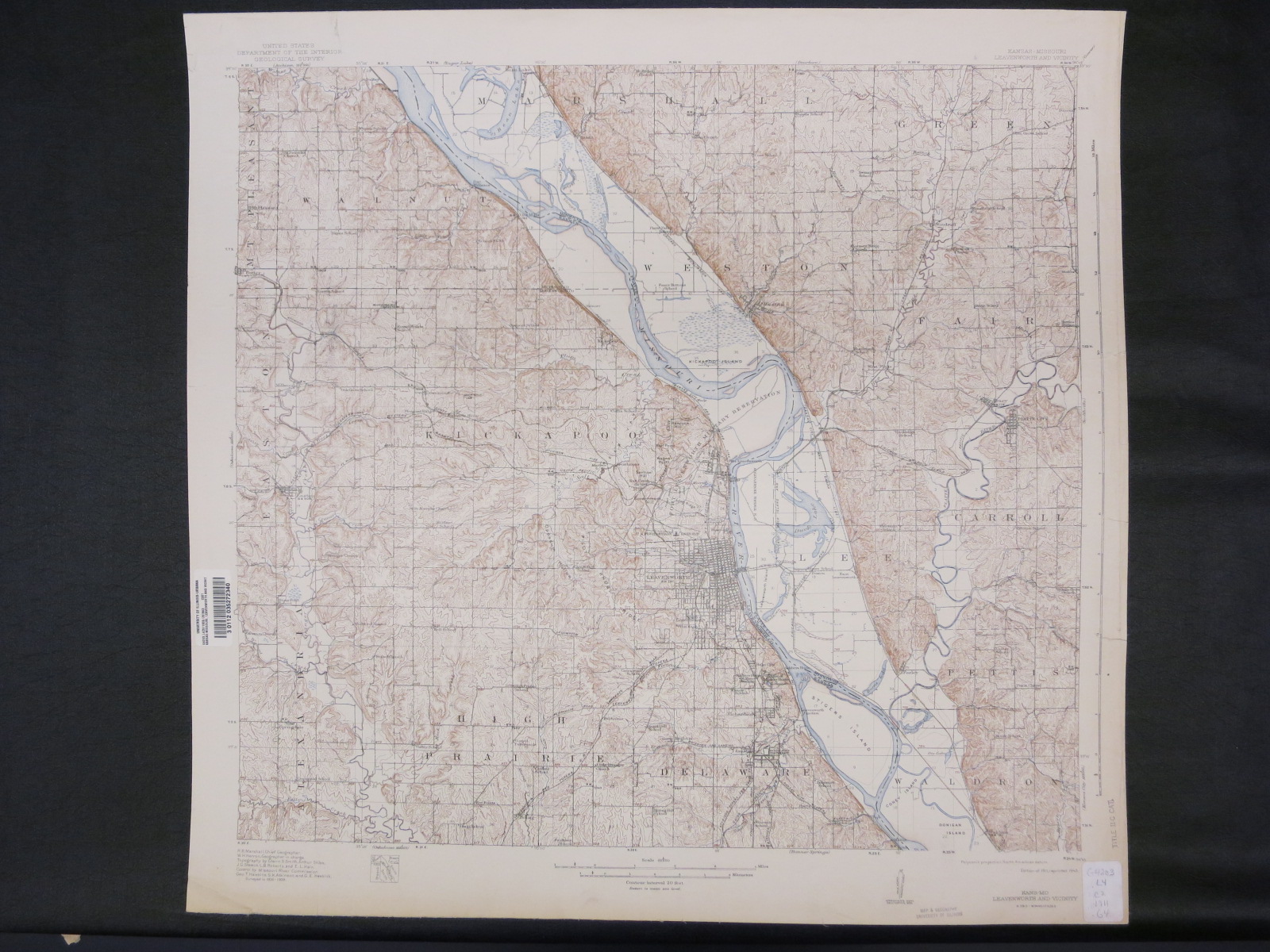
Topographic map surveyed 1906-1909. Shows most of Leavenworth County, Kansas, and part of Platte County, Missouri.
Kansas-Missouri, Leavenworth and vicinity. Edition of 1911, reprinted 1943. Scale 1:62,500. [Washington, D.C.] : U.S. Geological Survey, [1943]. Map Library call number: G4203.L4C5 1911 .G4