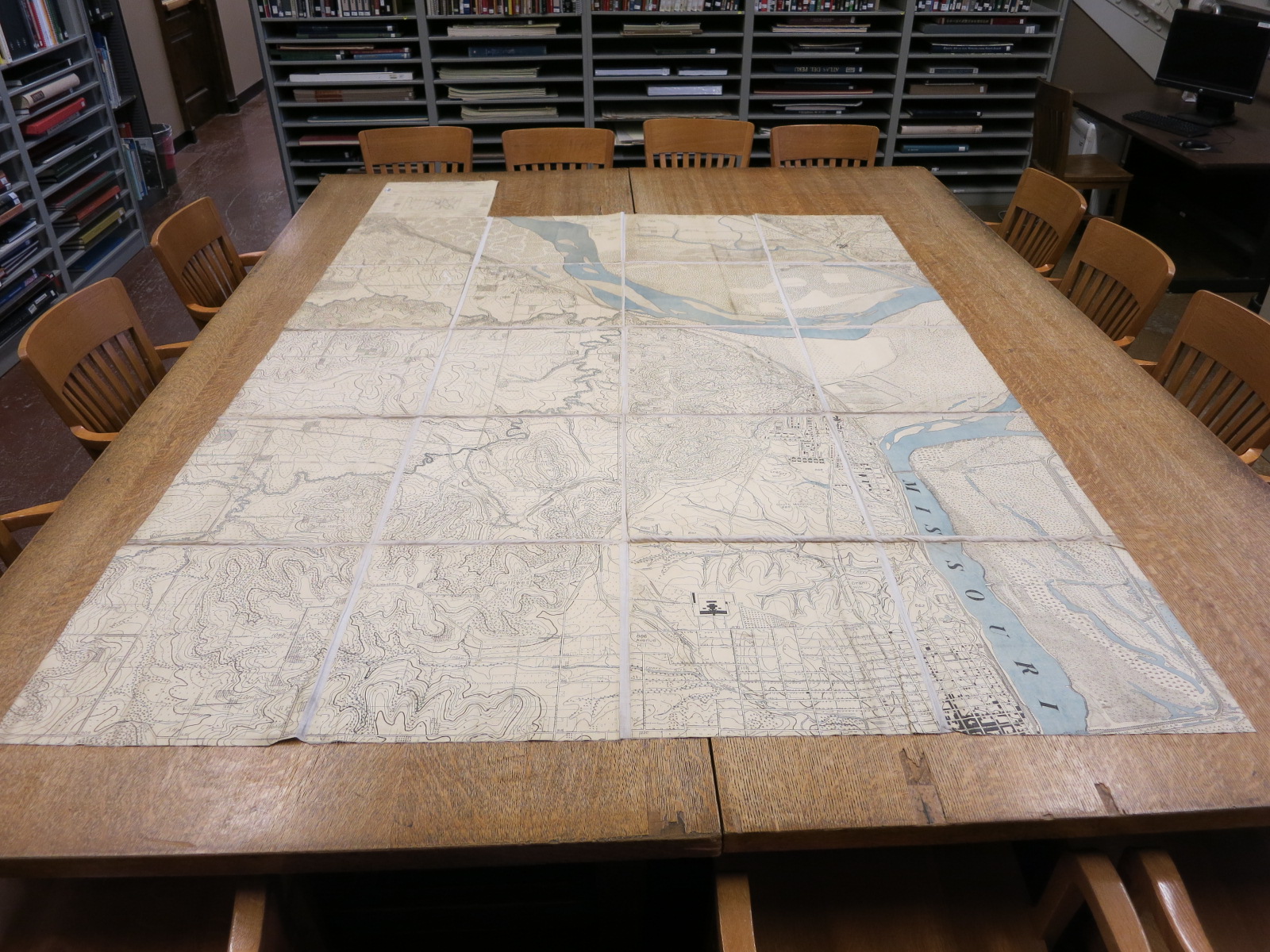
Twenty panels, plus legend panel, of a detailed map of Fort Leavenworth and vicinity intended for “map maneuvers” held as part of the coursework at the Army Service Schools. Each panel is approximately 18 x 18 inches.
Fort Leavenworth war game map : Platte City-Leavenworth-Easton-Waldron-Lansing, and Boling sheets / made at the Army Service Schools. Scale 1:5.280. Fort Leavenworth, KS : Army Service Schools, 1909-1913. Map Library call number: G4204.F4 1913 .A7