
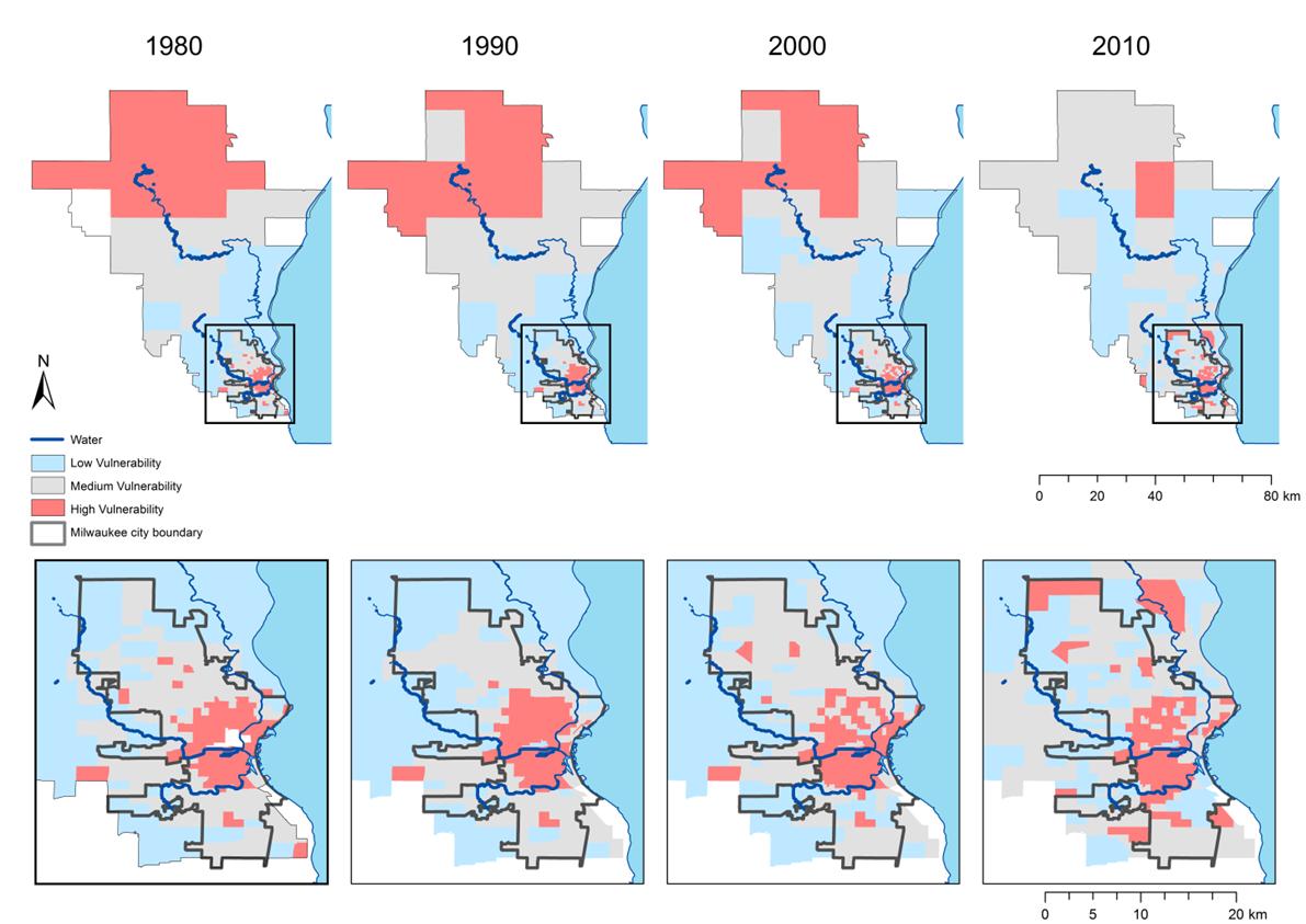
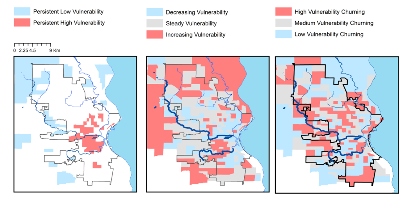
In addition to learning about social changes in Milwaukee through interviews with community members, we have also used digital mapping technology to look at how those changes effect populations that are most susceptible to harm. To create these maps, we obtained data from the U.S. Census Bureau portraying the factors that can cause some populations to face more adversity than others. We then synthesized that data to create a comprehensive index that would show how the distribution of vulnerability has shifted over time.