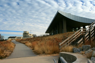
In early November, I took a group of students from my “Environmental Politics” class on a field trip to Indiana Dunes National Lakeshore. A few of them knew the dunes as a good place to go to the beach – but that wasn’t our agenda on a windy November day.
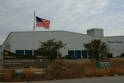
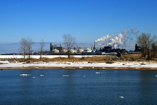
We started at the Portage Lakefront Unit to talk about the political history of the region. From the breakwater, you can see the full sweep of the Lake Michigan shoreline from Michigan City, Indiana, to Chicago. We couldn’t quite see Chicago, but the industry of East Chicago, Whiting, Gary, and Hammond were all visible.
At this spot, the park faces a steel mill across the channel of Burns Ditch. The Port of Indiana and a NIPSCO power plant, both of which serve the mill, are barely visible on the other side of the factory. The town of Ogden Dunes lies on the other side of the park, a well-to-do community that benefits from the protected landscape of the national park.
The political geography of national parks is nowhere more visible than here. Indiana Dunes National Lakeshore owes its existence to a political compromise in 1963. Dune advocates accepted a subsidized harbor bill while industrialists acquiesced in creation of a national park unit here. Each got the core of what they wanted, while each had to accept the existence of the other next door.
The geography of Portage Lakefront makes this compromise visible, and always sparks a conversation. How can nature and humans coexist? What are the benefits, and what are the costs? Seeing a national park, residential community, and major industry lying cheek-and-jowl shows students what these issues look like on the physical landscape.
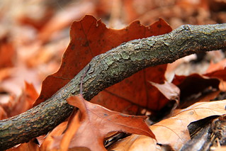
After Portage Lakefront, we explored the natural landscape that the park preserves. The best place to do this is the Cowles Bog Trail. The trail begins by walking along Cowles Bog, a National Historic Landmark that recognizes where Henry Chandler Cowles (1869-1939) pioneered the study of ecology. The swamp forest here includes pin oak, red maple, and yellow birch. Some of these trees are moving into the swamp and transforming it. In one stretch, the NPS kills these trees by girdling them, to halt this natural process of ecological succession. The park honors Cowles’ studies of ecological succession by arresting this process in time, thereby displaying it better in space – keeping both the fen and the swamp forest.
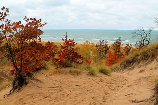
As we climb into the dunes, we gradually see more habitats, including oak savanna with black and white oaks and shrubs such as chokecherry, witch hazel and sumac. We pass some ponds behind the dunes, and then finally arrive at the foredunes above Lake Michigan. On top of the dunes we see various hardwoods that have established themselves. They can move in here because the marram grass near the beach has stabilized the soil and transformed the ecosystem, providing a place for cottonwood, oak, hickory, and white ash to move in.
These diverse microhabitats characterize Indiana Dunes, and explain why this small place holds more than one thousand plant species. Congress preserved not only recreational opportunities on the beach and trails but also a hotspot of biodiversity. Microhabitats are scattered among towns, factories and transportation networks – a microcosm of the wider problem of environmental politics today.
Can we preserve natural places and a full range of biodiversity in a landscape dominated by humans? Does preserving our natural heritage require killing native trees? While they enjoyed getting out of Champaign-Urbana for the day, we also left them with some questions for their reflective essays on the trip.
Additional links and resources
For four seasons in Indiana Dunes, see my Flickr set.
For my essay comparing Indiana Dunes with Michigan’s Sleeping Bear Dunes, see the National Park Traveler.
For my photo essay on the Midwest’s national park units, see Illinois Issues.


