Backpacking Campsites in the Deam Wilderness

Campsites in the Charles C. Deam Wilderness, Hoosier National Forest

The Deam Wilderness lies about 20 minutes southeast of Bloomington, Indiana, across Monroe Lake. It’s small by western wilderness standards, with only 13,000 acres. Websites and US Forest Service signs don’t provide much information about the campsites, including important details such as “is there water there?” This page should fill the gap.

Backpacking on the Peninsula Trail

The USFS has posted a helpful brochure on the internet here.

Page 1 has the camping regulations, while page 2 has a map of the wilderness showing the trails and campsites. Designated campsites have numbers on the map and most have signs identifying them in the field, though not always with the number. If you can read a map, you’ll be fine.

National Geographic’s Trails Illustrated Map of Hoosier National Forest provides greater detail and multi-color readability. The Deam takes up one side of the map.

I have camped at several of the sites reviewed here, visited a few more out of curiosity, and have seen most of the rest from the trail. I’ve noted the quality of information below.

Note: I mostly visit the Deam in spring and fall. Streams might not be a good source of water in late summer. Water quality in ponds probably goes down as summer drags on. Monroe Lake lies behind a dam and always has water.


Sycamore Loop Group

Kobuk on the Sycamore Loop

The Sycamore Loop is 4.7 miles in length. The south side of the loop sticks to a stream before ascending to a ridge for the north side of the loop. It would make an attractive day hike. That hike would be about 6.2 miles, closing the loop on the west side and adding the connector to the trailhead. Campsites 1-4 are all on the south side of the loop.

Campsite 1 seems to refer to the campsite at the junction of the Terrill Ridge Trail and the Sycamore Loop Trail. It’s close to the parking lot, visible from both trails, and lacks water. If you’re just looking to camp without any cars around, that’s your site. It’s close enough to haul an ice chest, lawn chairs, firewood, and other things I leave in the car.

If you go down the Sycamore Loop Trail, you’ll hit an unmarked campsite near a creek at the bottom of the hill, tolerably close to where the map shows campsite 1. (I have not seen a numbered sign at either place.) There are flat spots there that would meet the requirement of being 100 feet from the trail and 100 feet from water. It’s a lovely site, within view of both stream and trail. If this is campsite 1, leave the ice chest and lawn chairs in the car.

Campsites 2, 3, and 4 are similar to that last site. Each has good water from the creek, flat tent sites, and fire pits. Each is visible from the trail, though campsite 3 is less visible than the others. They are not particularly private, but most campsites in the Deam are not.

Campsite 5 sits next to a beautiful little pond. The current trail runs on the opposite side of the old horse trail, so you have a little distance from hikers. There is less flat space here than at other sites, so I wouldn’t plan to put a big group here. There’s vegetation all along the shore, so there’s a minor bother to get to the pond, and the views aren’t as nice as campsite 6 has of its pond.


Terrill Ridge Group

Pond at Terrill Ridge


This group lies atop Terrill Ridge, which has access on a wide, well-graded trail that seems like a former road or wagon route. Where the trail turns left to a cemetery, there’s a little trail off the right that’s marked “no horses.” That narrow, winding trail gives you trail access to the sites. (Some are better reached by water.)

Campsite 6 sits on a beautiful pond. Depending on your definition of “site,” there are 2-4 around the lake, as well as one behind a berm with good access to the pond. This was a popular day hike destination when I camped there, so there was quite a bit of traffic. The best site for a lake view is also the least private.

The (unmaintained) trail continues along Terrill Ridge. There are several spots you might camp, all of which meet the USFS requirements for undesignated campsites. The end of the ridge was the most attractive, with peekaboo views of Monroe Lake. None of them have water.

The end of the ridge would seem to have access down a steep hillside to campsites 7 and 8. I haven’t tried that, so it’s just a guess.

A crossing of Axsom Branch

I have not seen campsite 9, accessed by foot from the bend in the Axsom Branch Trail. I should note that campsites 7, 8, and 9 presumably appeal to boaters and not backpackers.


Grubb Ridge Group

Kodiak guarding the tent at a Grubb Ridge site.

This is a small group of campsites at or near the junction of the Grubb Trail and the Peninsula Trail. They’re only 2.5-3.0 miles from the Grubb Ridge Trailhead.

Campsite 12 sits right next to the junction, so it’s not at all private. There is also no water. However, there’s room for a bunch of Boy Scouts, which I have seen done.

Campsite 13 is a stock site close to 12. I’ve seen it but haven’t explored it.

Down the hill from campsite 12 are campsites 14 and 15. They’re easily visible, and the best route down seems to be a little bit down the Peninsula Trail after site 12. I haven’t tried it, but the route looks steep but straightforward. I once met two guys coming up from those sites, who liked them. They were hunting, and the off-trail nature of the sites had attractions for them. The sites are just above Monroe Lake, so water is good.


Peninsula Trail Group

These campsites seem to be the most popular in the Deam Wilderness. Judging by the trail traffic, most people access them from the Grubb Ridge Trailhead. It’s 5.3 miles from there to the tip of the peninsula. (There’s a Backpacker page that claims it’s 8.8 miles, but that disagrees with the USFS map and with the fact that I can hike this trail in under two hours.)

Sunset from the Peninsula

The tip of the peninsula is a beautiful place for sunsets year round. Easy access to water from Monroe Lake. You won’t be alone – campsites 18, 19, and 20 receive high use by backpackers and occasionally boaters. Plan to get there early on a weekend (or Friday).

Campsites 16 and 17 require bushwhacking from the trail, and they don’t have the views across the lake. Campsites 16 and 17 also seem to be most popular for boaters who don’t clean up after themselves, and there always seems to be weird trash there.

Campsites 21, 22, 23, and 24 may be accessible along the shoreline from sites 19-20, or they may not. As a rule of thumb, the higher-numbered sites require lower water levels to be accessed by foot along the shore. Bushwhacking may be an option, but 23 and 24 may require you to ford streams to reach them in this direction.

You might be able to reach 24 by bushwhacking from Grubb Ridge either down from the ridge, or along the stream from the trail’s low point. I haven’t tried that. I have bushwhacked up from 23 most of the way over to 12. Route-finding to 23 from the other direction might be tricky.


Cope Hollow Trail

I have no information on campsite 25, a stock site on a trail I haven’t hiked.


For more photos, see my album on Flickr.


Idaho and Nebraska

Among other experiences this year, I’ve been fortunate to spend some extended time in Boise, Idaho, and Kearney, Nebraska. In both places, I talked with people about eco-tourism, environmental issues, protected areas, and sustainability, in various mixes. Both are very red states, and both economies have strong primary sectors. People talk about agriculture and livestock in both states, as well as forestry and mining in Idaho. Even so, they see the relationship between humans and nature in very different ways. Context matters.

In Idaho, I participated in the Idaho Environmental Forum. After that, I gave a talk on national parks at Boise State University. I also wrote a piece on the national parks for the Blue Review, an online magazine of the Idaho Center for History and Politics. In Nebraska, I participated in “Plains Safaris,” a conference on tourism and conservation in the Great Plains, sponsored by the Center for Great Plains Studies and Visit Nebraska. Idaho connected best to my teaching and research on Environmental Politics, while Nebraska connected to my teaching and research on Recreation and Tourism.

The occasions were very different, but it was striking that people in Idaho tended to talk about “environmental” issues while those in Nebraska tended to talk only about “conservation.” Not surprisingly, people in both places talked in terms of conservation when talking about hunting and fishing. The word “preservation” could be heard in both places, but in Nebraska it might refer more often to historical or cultural preservation than to the environment.

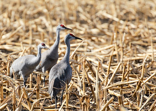
Waiting

Despite the important role of hunting and fishing in how people imagined both places, there were also significant differences. I don’t remember anyone talking about birdwatching in Idaho, but it’s pretty salient in Nebraska. Because the cold winter and spring were keeping birds a bit longer than usual, we also got to see a lot of sandhill cranes in Kearney and pelicans at Harlan County Lake.

The conversations in both settings were also stamped by strong regional differences. Not surprisingly, the politics of the two large urban areas (Omaha-Lincoln and Boise) differ from the rest of the state. Each holds the state capital, several headquarters of large businesses, and each is the home of the largest university in its state. Conversations about environmental issues in the cities tended not to be much different from other US cities I know.

Outside the cities, there were obvious differences in the environmental issues salient for the Snake River region, Idaho Panhandle, and Eastern Idaho, among other regions. The Nebraska Panhandle, Central Nebraska, Niobrara River, Lake McConaughy, and Rainwater Basin stood out among the regions we discussed in Plains Safaris. Nebraska has other regions that we didn’t discuss, such as a piece of the Flint Hills. No matter the region, birds often shaped the conversations. Sandhill cranes and the Platte River, the wetland habitats of the Rainwater Basin, and the rich biodiversity of Lake McConaughy were recurring themes.

Perhaps the biggest difference between the two states is the role of the federal government. Federal lands make up almost two-thirds of Idaho, but only a little over one percent of Nebraska. As a result, you can’t talk about the environment in Idaho without talking about federal lands. In contrast, the feds were almost entirely absent from the conversations in Nebraska. State government and non-governmental organizations (NGOs) were where the action was.

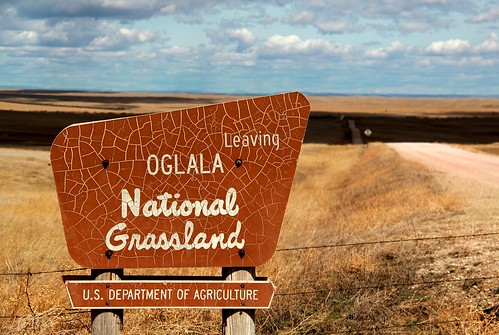
Leaving Oglala National Grassland

The role of the federal government is particularly visible when we compare the visibility of federally-designated wilderness areas in the two states. Nebraska has only two small wilderness areas, each less than 10,000 acres. I’ve hiked near, but not actually in, each of these. They lie in lovely country, one outside Valentine and the other outside Fort Robinson. They don’t seem politically visible, and the ecotourism conference did not discuss them.

Idaho, in contrast, has 15 wilderness areas. All are big. The largest three are the Frank Church-River of No Return, at 2.4 million acres, the Selway-Bitterroot (1.3 million), and the Owyhee (1.1 million). With such “untrammeled” spaces available, wilderness is central to conversations about the environment in Idaho.

Surprisingly, there were fewer differences in the conversations about Indian Reservations. There are five reservations in Idaho, four of which have large landholdings. Nebraska has six reservations, but only two can be described as reaching a “modest” size. That count includes Pine Ridge, which has significant off-reservation landholdings in Nebraska.

Plains Safaris

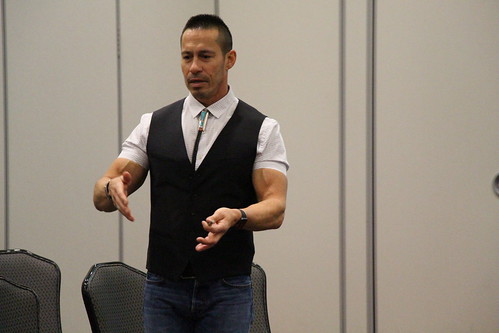
The Plains Safaris organizers included two Native speakers, one of whom is a national park employee, and one non-Native who works closely with a tribe in Oklahoma. That may have made Indian Country more visible than it otherwise would have been. Those sessions were all very well attended, so there is clearly significant interest in partnering with tribes in the ecotourism sector. The NATIVE Act of 2016, which was mentioned in several presentations, will encourage such partnerships.

The role of state government in the conversation also varied considerably. Not surprisingly, both state governments support the role of the primary sectors in the state economy. In Idaho, only the difference between Boise and the rest of the state appeared in our conversations about state politics. In Nebraska, state government, fish and game, bird conservation, and tourism development were among the salient issues.

Each state has an agency in charge of tourism promotion. Not surprisingly, the themes of tourism promotion differ considerably. The Nebraska Tourism Commission  cosponsored the Plains Safaris conference, so of course it was visible at the event. Its website also makes ecotourism, broadly defined, part of “The Good Life” you can experience in Nebraska. Themes such as nature, agritourism, gastronomy, adventure tourism, and outdoor recreation make up almost half of the topics on the Visit Nebraska website. I’m associated with one of these subtle glories, the Great Plains Trail. We were just featured in the June 2018 issue of Backpacker magazine – check us out here.

The Plains Safari conference also featured small-town Nebraska, reachable along scenic byways. (The Heartland Byways Conference, under the auspices of the National Scenic Byways Foundation, was held in conjunction with the main conference.) Chambers of Commerce, town governments, and other local bodies were very visible in the Nebraska conversations. Willa Cather’s fiction, grounded in small-town Nebraska, was a common point of reference.

The Idaho Division of Tourism Development emphasizes very different themes than Nebraska does. Their website stresses “Your Idaho Adventure,” and the eight themes it features all concern outdoor recreation. You have to scroll down quite a while to find the first urban theme, which is beer.

Plains Safaris

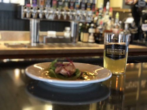
Beer also makes the Nebraska list, and I encourage my Midwest friends to explore brewpubs in Omaha. Gastronomy is also visible in Nebraska’s tourism promotion. That’s easier to sell in a diverse agricultural state than in a state with “Famous Potatoes.” That said, Boise’s restaurants do a great job featuring obscure but flavorful potato varieties.

Non-tourism businesses also made an appearance at the events I attended in each state. The J. R. Simplot Company, which commercialized french fries for McDonald’s and other retailers, is very visible downtown but did not connect to our environmental discussions. Timber company Boise-Cascade  has important effects on Idaho’s forests, and was very visible.

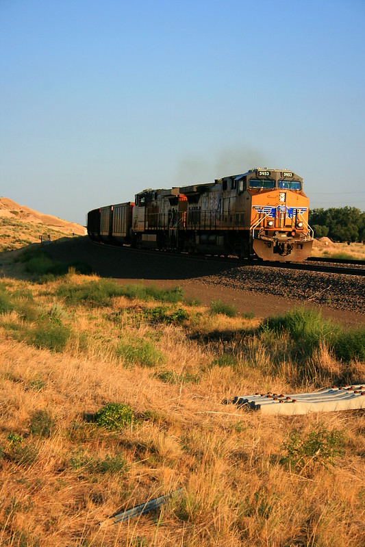
Union Pacific 5953

Nebraska’s large businesses also affect the environment, of course. As a transportation company, Union Pacific is a major energy user. Because its most important freight is coal, it also contributes indirectly to coal consumption and thus to carbon emissions. However, these kinds of sustainability concerns are not visible on the ground in Nebraska. The environmental impact of “Uncle Pete” seems to be a national issue, not a local one.

My experiences in these two states made visible the highly-contextural, textured nature of environmental politics. This won’t surprise geographers and historians, but political science texts tend to focus on national politics. That means that political scientists end up focusing on pollution regulations, climate change, and things like energy policy. Those are important, but they leave out how the environment looks to people. Idaho and Nebraska illustrate how important it is to develop a nuanced understanding of how local residents see the relationship between humans and nature.

It’s also important to compare and contrast local politics and not just study a single site. That’s why I teach places like the Greater Yellowstone Area, Northwest Indiana, or the Four Corners region in my environmental politics classes.

Yellowstone backcountry campsites

This page reviews my experiences at many of Yellowstone’s backcountry campsites, both those where I have camped and those I have only seen along the trail. (I have eaten lunch at some of those.)  I have about 350 miles of backpacking experience in the park, though about half of those miles are “repeat” miles. Those miles include both personal trips and those in which I have led a group.

I’ve taken Illinois students backpacking in Yellowstone four times in late June and three times in late July. There are still bear closures in most of June, which rules out a number of sites I’d like to use. Even in late July some places still restrict off-trail travel. Most sites are limited to eight people, so I have often needed two sites for the short backpacking trips. The online reservation system and permit lottery now makes this two-site strategy difficult; in the past, backcountry rangers were helpful in providing options and explaining the rules in such cases.

Two of those group trips have gone to the Thorofare because it has a lot of 12-person sites. We limited group size to make that work.

My student groups have generally consisted of backpacking novices, though the two Thorofare trips had many experienced members. I’ve learned that it’s best to aim for distances around 2-5 miles, which works well for overnights or three-day weekends. Grebe Lake is at the low end of that range, the Gardiner sites at the higher end. For groups of 4-6 people, Heart Lake sites would be great but they are nine miles from the trailhead. The Snake River sites would also be great. Later in the season you can ford the Snake at the South Entrance; earlier in the season, you use an informal trail south of the park, across a bridge, and park on the east side of the river. That adds a couple of miles.

The Thorofare trips need people who can cover more miles since the minimum round-trip distance is 65 miles (plus spur trails to camping sites). I would recommend at least six nights, planning on days of 8-12 miles.

In addition to advice for backcountry groups, I thought I’d add reviews of other sites I’ve used. I’ve compared my impressions to Bill Schneider’s Hiking Yellowstone, which reviews every hiking site in the park. The park retires sites regularly, or restructures trails. Some of my reviews are updates to Schneider’s book. I have also drawn from the data in Thomas Bohannan’s Yellowstone Trail and Backcountry Field Guide.

One frustration in Yellowstone’s backcountry is that most official sites don’t follow the park rules. Ideally, your sleeping area, cooking area, and food storage area should each be 100 yards apart. You should sleep upwind of the cooking and food storage so that those food smells don’t lead a bear to your sleeping area. Not one of the sites reviewed here follows all of those rules. Most of them have a fire ring and cooking space directly underneath the bear pole. Some use constricted spaces that will leave your tents 10-25 yards from the cooking area.

Gardiner River

1G3 and 1G4 provide a pair of sites that work well for a group. You can put two eight-person crews here, within an easy walk of one another. Unfortunately, neither of these sites have a view of Electric Peak. However, either one would make a good basecamp for a climb of Electric.
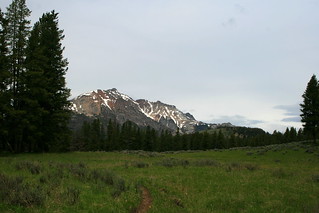
Electric Peak1G4. This site is close to the Gardiner River water source. This site is very open with a big fire circle that is great for a group. The campfire has very good views across the meadow and into the lower portions of the Gallatins. Even though this site is visible from the trail, I’d choose this one over 1G3 if I were backpacking by myself.

1G3. This is a more closed-in site. It is much more private than 1G4, located some distance off the trail. It does not have any real view from the cooking area or tent sites. It’s about a hundred yards to the river water source.
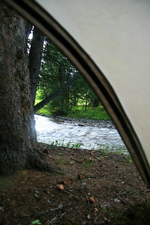
Gardner's Hole1G2. This site is also on the Gardiner River, but it’s on a different trail than 1G3 and 1G4. You can’t accommodate 16 people here. Schneider gives this site five stars, but I can’t figure out why. He likes it as a private site with a good view, tent sites, and water source. I certainly agree on the tent sites and water source, but there were no real views from the site. You can get some good views if you walk upslope a bit from the sites (no trail), but hte sites are in the woods by the river.

The nearby site 1G5 is for stock groups only, but it better fits Schneider’s review. It’s possible that he mixed up the two sites in his notes. For views similar to mine, see http://www.trailguidesyellowstone.com/yellowstone_hikes/fawn_pass_trail_east_yellowstone.php

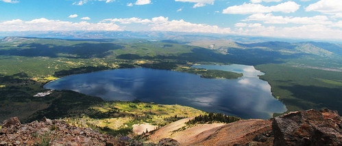
Grebe Lake

There are three sites on the north side of Grebe Lake that would work well for groups. We used 4G3 and 4G4, but 4G5 would also pair well with 4G4. 4G3 and 4G4 are a little farther apart than I’d like for a group, and the trail between them is indistinct. The lake was very buggy in late June, and the area mostly seems to attract anglers. All three sites had clear views of 4G2 on the other side of the lake, which was also occupied. This reduces the privacy.Guard uinta
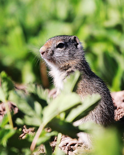
4G3 parallels the trail. It has beautiful views of the lake but is not at all private. The tent site, bear pole, and eating area are spread out in a line and more separate from one another than is true at most Yellowstone backcountry sites. There’s a community of Uinta ground squirrels between the campsite and the lake.

4G4 is a real winner, though the bear pole, eating area, and tent sites are closer together than they should be. The site is hidden in the woods but looks out over the lake.

Snake River

8C1. I love the views from this site, which go up and down the Snake River Valley. The bear pole, eating area, and tent sites line up parallel to the trail, reasonably spaced out but nowhere near the official recommendations. Because we don’t make campfires, we ate away from camp on bluffs overlooking the river. You don’t have any privacy, and the trail attracts a fair number of horsepacking groups on their way to sites on the national forest.
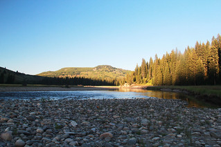
Snake River MorningThere are other sites within a reasonable distance that would make this work for a group. They’re a little farther apart than I’d like, though.

Thermal features flow into the Snake River in this area, creating one legal (and safe) soaking area next to the river. You should be aware of the risk of the Naegleri fowleri parasite, which is deadly.

Basin Creek

8B1. This site has been moved since Schneider wrote his book, and the nearby trail junction has been restructured a bit so that the site is south of the junction and not north as the maps show. Signage was not yet adequate when we were there.

Schneider calls it “semiprivate,” but it’s now a very private site. Because it’s new, it lacks a defined spur trail. If you’re coming from Snake River, look for the sign and walk uphill across the meadow. You’ll find the site in the woods. If you’re coming up the Basin Creek Cutoff Trail, turn left at the junction with Heart Lake, not right. (The NPS failed to tell us this; you might ask for details at the backcountry office.)
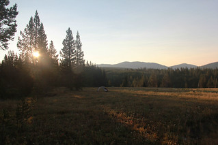
Basin Creek Sunrise
Inexplicably, the cooking area, bear pole, and best tent site are all on top of one another, so don’t use that tent site. It’s hard to find level sites in the woods, so we just found a hard site in the meadow. The meadow has quite a few bison wallows, and I wouldn’t use those! As campers have explored the site since we visited, you might find some tent pads at the edge of the woods looking over the meadow There are great views toward Overlook Mountain from that meadow, so enjoy.

Heart Lake

There are five campsites on the west side of Heart Lake. 8H2 and 8H3 share a new spur trail, but are otherwise private. We could see 8H2 from our bear pole, but the campers there never showed any awareness of us. Both sites are on the lake and allow campfires. 8H2 has a composting pit toilet with no walls. It’s visible from the cooking area, which is another example of poor landscape design by the NPS. However, we never had any problems with smells.
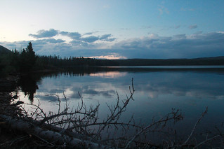
Heart Lake sunset
We only found one good tent site at 8H3. It has a good view of Mount Sheridan, but not of Heart Lake. However, there is a shoreline area along the lake where we watched sunrises, sunsets, and beavers.

All of the Heart Lake sites are great basecamps for a hike up Mount Sheridan. That’s a nine-mile round trip from 8H2 and 8H3, a little less from 8H4-8H5-8H6, and at least a mile more from 8H1.

Thorofare and Southeast Arm

Park Point offers a group of three sites and a trailside pit toilet. Two of those sites, Park Point North (5E8) and Park Point South (5E9), have beautiful locations along the lake. Their meadows are also mosquito-breeding facilities, a feature you’ll notice if there is no lake off the breeze. The third site (5E7) is back from the lake, in a marshy area that has a ferocious mosquito population and no views. Avoid that one.

Three miles further south you’ll find Columbine Meadow (5E6), a lovely spot where I have had lunch but never stayed. This is nine miles from the trailhead, so it gives you the mileage you need for your first (or last) day on the trail to the Thorofare Ranger Station.

5E4 Brimstone Bay is a lovely lakeside side with a beautiful view of Yellowstone Lake and Promontory Point, down an easy 0.2 mile spur from the trail.  It rightly earns five stars from Schneider. My only concern in August 2017 was that there were a lot of snags in and around the campsite – one fell down during our dinner on a perfectly calm day. While the park had cleaned up those by July 2022, my students found new widowmakers. Place your tent well.
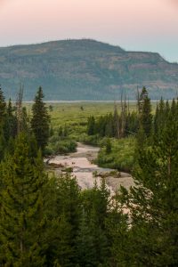
The Beaverdam Creek area has two campsites some distance apart, and my old map shows that both of them have been moved. Beaverdam Creek 5E1 is west of the trail, on a spur that will take you a few hundred yards away from the junction – and your water source at the Beaverdam Creek ford.  The tent sites are squeezed into a narrow space between a steep slope and the forest, but the views are fantastic. It’s a long way to water, though.

6B4 Beaverdam Meadow seems to have new routing when we were there in 2017, with about half the 0.4 mile spur trail essentially guesswork through a meadow.  That meadow seems popular with horse parties, and we saw a lot of, uh, horse sign there in 2017.  Horse sign was much less in 2022 and 2023. The food area and tent sites don’t have views. It’s a short walk to the creek, with constricted views of the mountains but lots of privacy. This site is the approximate location of one of the 1870 Washburn-Langford-Doane Expedition’s campsites, and still gives a group lots of room.

6C2 River’s Edge is a beautiful site on a bluff above the Yellowstone River with a number of good tent sites.  When the river is high (as in 2017), it was challenging to get down the bluff to water. Unless you’re on horse, the mile-long spur trail entails some route finding to cross streams in the meadow and to reach the well-marked campsite.

6D3 surprised me. It’s on a small triangle of land between braids of Mountain Creek, barely hiding out of view from the trail. If other hikers or, say, a bull bison are using the ford, you’ll see them if you step ten feet from the cooking area. The sunset views were glorious to both the west and the east, as the warm light hit the Absarokas. Schneider only gives it three stars because it’s not exactly private, though traffic is so light on the Thorofare Trail that I don’t think that’s a problem. I’d give it five stars for space, “swimming” hole, and views. The only downside is that, no matter which way you’re traveling, you start your morning with a ford. Brrr!

6Y6 Three Mile Bend on the Yellowstone River has a beautiful view and a lot of mosquitoes. This was the only place we used our head net in 2017.  Most of the group used head nets in 2022, though I didn’t. The mosquitoes were better behaved in 2023, and don’t remember anyone using the head nets both nights. It’s easier to get down the bluff for water than it is at 6C2, but there was no flat space at the river’s edge in 2017 – we were balancing on slick mud. In 2022 and 2023, water levels were lower and we had a nice beach downstream from the camp. The spur trail required some bushwhacking through the willow, but the route finding is easy if you stay close to the river.  (Horse parties will want to stay away from the river and look for a gap in the woods to the left once the river is no longer visible.) There was a lot of bear sign there in 2017, and we met someone who had a grizz examine her bag at the food pole two days before. We heard wolves both nights in 2022 and 2023, with fresh wolf and elk prints the first morning.

6Y5 Cliff Creek. I have not been to the actual campsite, but it clearly lies inside a stand of trees downhill from the trail and at the edge of a wetland. Some parts of the site are visible from the trail. Looking up, Cliff Creek descends between two arms of The Trident, and supposedly you can scramble to the falls. I had reserved this site in 2022 but the bear pole was damaged in the June storms so the NPS rerouted us. Next time.

Shoshone Lake
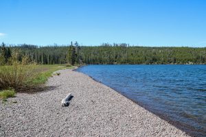
8S0 and 8S1 are two campsites next to each other, both next to the Shoshone Lake Ranger Cabin.  The paddler site is just back from the lake, with the lovely beach you see here. I had lunch here before exploring the eastern shore. The backpacker site is back from the lake and right next to the trail, with a terrible pit toilet. The two sites seem to have been classified as one in Schneider’s book, and he gives the paddler site four stars.
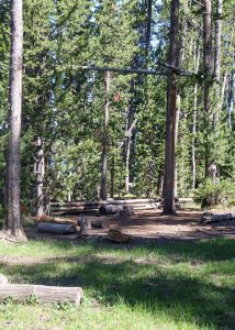
8S1. The backpacker’s site is further inland, near the trail junctions. The backpackers’ site has peek-a-boo views of the lake. It’s an easy walk down to the beach, offering great views of beautiful Shoshone Lake. As you can see in the photo, the backpackers’ site is serviceable but unexceptional. The outhouse has reached that stage (in 2022) where screws and nails no longer hold everything together, so gravity makes those decisions.

8S2. I didn’t stay here but walked through the middle of it, and talked to someone staying there. There’s a tent spot about 10-15 yards of the trail but the cooking area is right on the tail, with the lake on the other side of the trail. Pretty but not private.

8S3. This was empty when I walked through it, but is similar to 8S3 with perhaps a little more privacy.

8R5. This is a gorgeous site well off the trail. The bear pole and cooking area are on a small bluff above the lake. You could also bring your food down to the shoreline for views of the Shoshone Geyser Basin and Shoshone Lake.  The site lies down a good spur trail, about a half-mile from the trail. There’s a pit toilet (no walls) and abundant tent sites, all an appropriate distance from the cooking area and each other. The shoreline offers great sunrise and sunset views in September. The site is very private unless you’re on the shoreline and a canoe goes by on the way the geyser basin.

Outstanding opportunities for solitude

The Wilderness Act of 1964 defines a wilderness area as a place where, among other values, one may find “outstanding opportunities for solitude.” Because of their popularity, it’s often hard to find solitude in national park wildernesses, especially during the tourist season.

In this article for National Parks Traveler, I recount how I found solitude in a popular national park on a busy Memorial Day weekend.

Teaching the National Parks

Robert Pahre and Carie Steele, “Teaching Politics in the National Parks,” Journal of Political Science Education, 11(3): 301-318.DOI: 10.1080/15512169.2015.1047099

Abstract

Other than trips to government offices, political science has generally not used field experiences as part of the undergraduate curriculum. To illustrate the possibilities of such experiences, we discuss field-based courses and curricular units at three sites. Each uses a national park to teach students about environmental politics and policy issues. The course designs use experiential education theory to define learning objectives and the means to achieve them. We provide evidence from students’ self-reported academic and nonacademic outcomes that is consistent with the expectations of experiential theory. Not surprisingly, course evaluations are high. More important for experiential curricula, students report high levels of motivation in these courses, whether the experience is long or short, whether advertised in advance or not. Though self-selection may explain some of the positive outcomes, two before-and-after surveys suggest that experiential outcomes exceed expectations in interesting ways. In short, students like field experiences, the field experiences motivate them to learn, they learn more effectively, and they enjoy these courses more. Experiential opportunities should play a more important role in the political science curriculum.

If you’re interested in seeing the entire paper, please email me at pahre@illinois.edu for the access code.

Yellowstone 2013: Geology

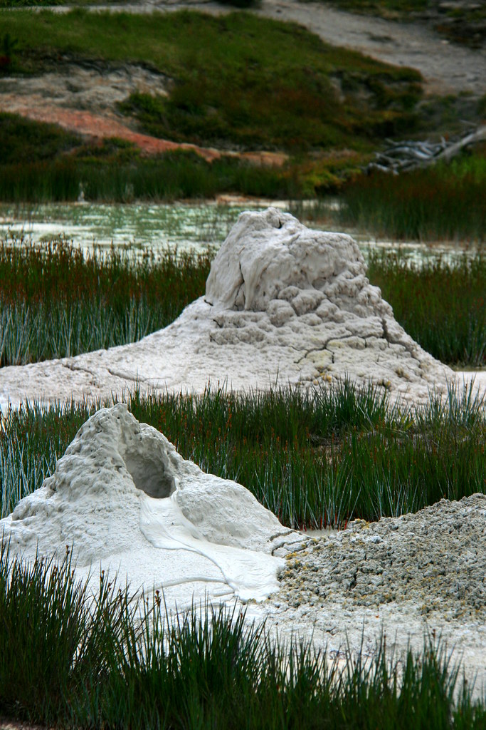
Two Cones

Yellowstone is famous for its geology.  The park holds more than half of the world’s thermal features.  Its surface appearance reflects the activity of a huge caldera that last erupted about 650,000 years ago.  The Yellowstone River carves a spectacular canyon, the Grand Canyon of the Yellowstone, that holds two beautiful waterfalls, 308 and 109 feet high.  There are petrified forests atop Specimen Ridge inside the park and in the northern Gallatin range just outside it. Mountains such as the Gallatin, Beartooth, and Absaroka ranges ring the park, and the Red Mountains lie entirely within it.

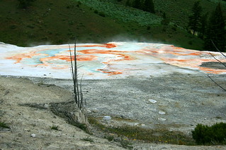
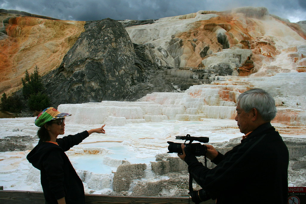
Terrace at Mammoth Hot Springs

Despite those riches, geology is an awkward subject for a class on the “Politics of Yellowstone.” The federal government does not have a policy on place tectonics or volcanism. With rare exceptions, we do not have a geyser policy. At the same time, it would be stupid for the course to ignore these wonders. The students rightly want to see this famous geology while they’re in the park.

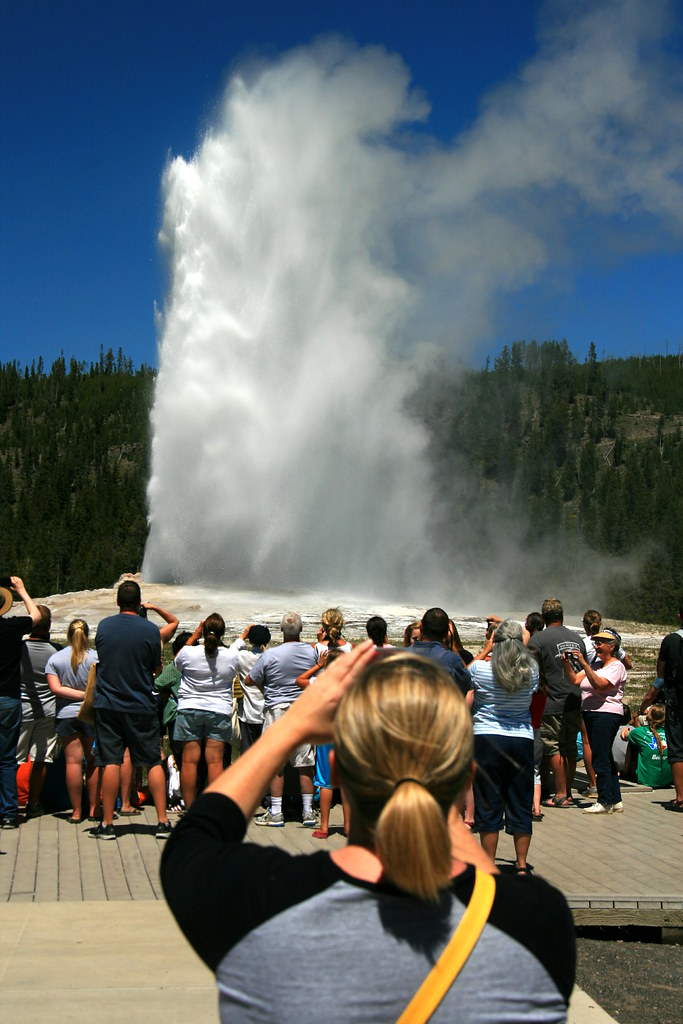
Old Faithful

What to do?  We use the scenic geology to start talking about tourism. By visiting tourist-heavy destinations like Old Faithful or the Grand Canyon of the Yellowstone, we examine the impact of tourism development on the environment. Finding a geyser along the trail in an isolated area is very different than viewing Old Faithful from a boardwalk surrounded by hotels, restaurants, gift shops and parking lots.

Our first examination of these issues in 2013 came along a trail I call the “Yellowstone Sampler.” We see some unfenced thermal features in the backcountry and usually walk fairly close to some bachelor bison groups at the north end of the Hayden Valley.  After lunch at a scenic spot, we emerge from a moderately-low use trail to the crowds and parking lots of Artist Point.  The transition is pretty sudden, which makes it a good place to talk about developed tourism and personal experiences of nature.

Stumped!

The hike encourages students to think about “wilderness” – the Wilderness Act of 1964, students’ personal definitions of nature and of wilderness, and the views of other people. Does wilderness matter to people? Is it important for well-functioning ecosystems? Does the preservation of the world, as Thoreau wrote, lie in wildness?

Specimen Ridge


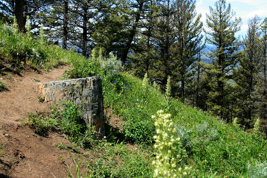
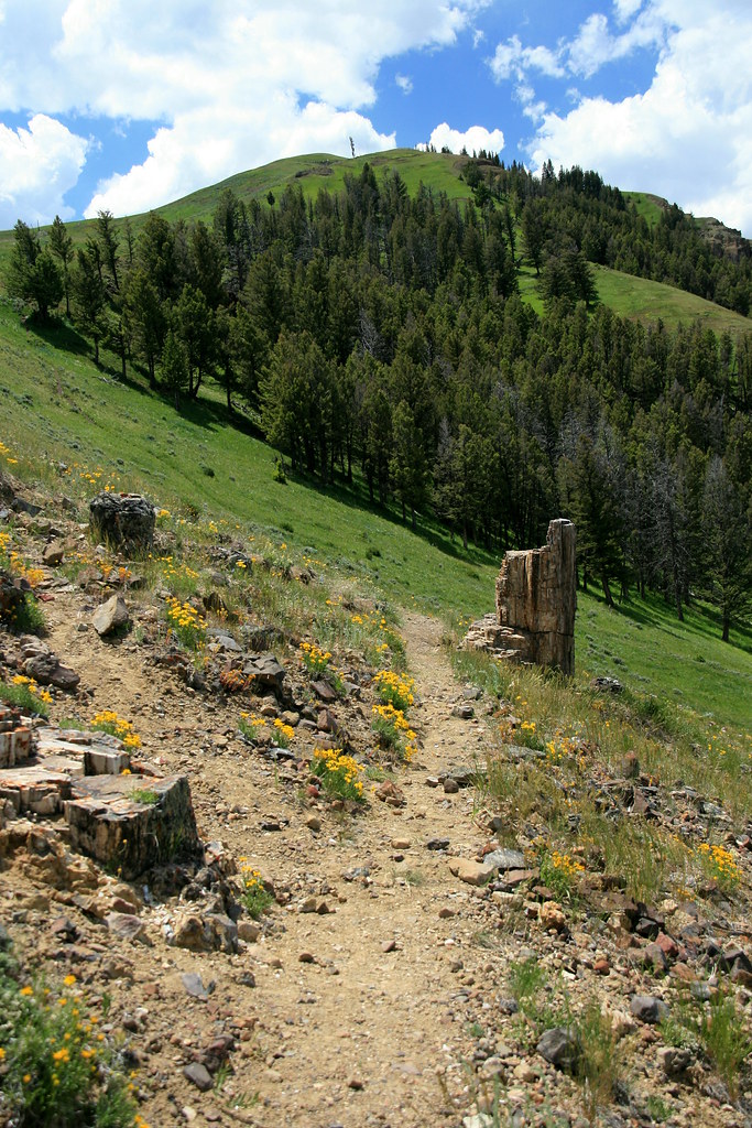
In 2013, I added a new hike to our second full day in the park.  As part of our driving tour of the Lamar Valley’s wildlife, we climbed the lower reaches of Specimen Ridge to reach a petrified forest.  This was a remarkably steep trail, posing a definite physical challenge – but one that rewarded us with great views from high above the Lamar. We remained in sight of the park road, but the physical challenge contributed to the wilderness feel of the experience for many students.

Though some guidebooks describe it, Petrified Forest is an unofficial trail, not found on park maps. The Park Service does not maintain it, so people find their own track.  This results in many social trails and greater impact on the landscape.

In some parks, there might be a road going up to a site like this.  Instead, Yellowstone has decided to keep these petrified trees unpublicized, accessible only by a difficult and unmaintained trail.

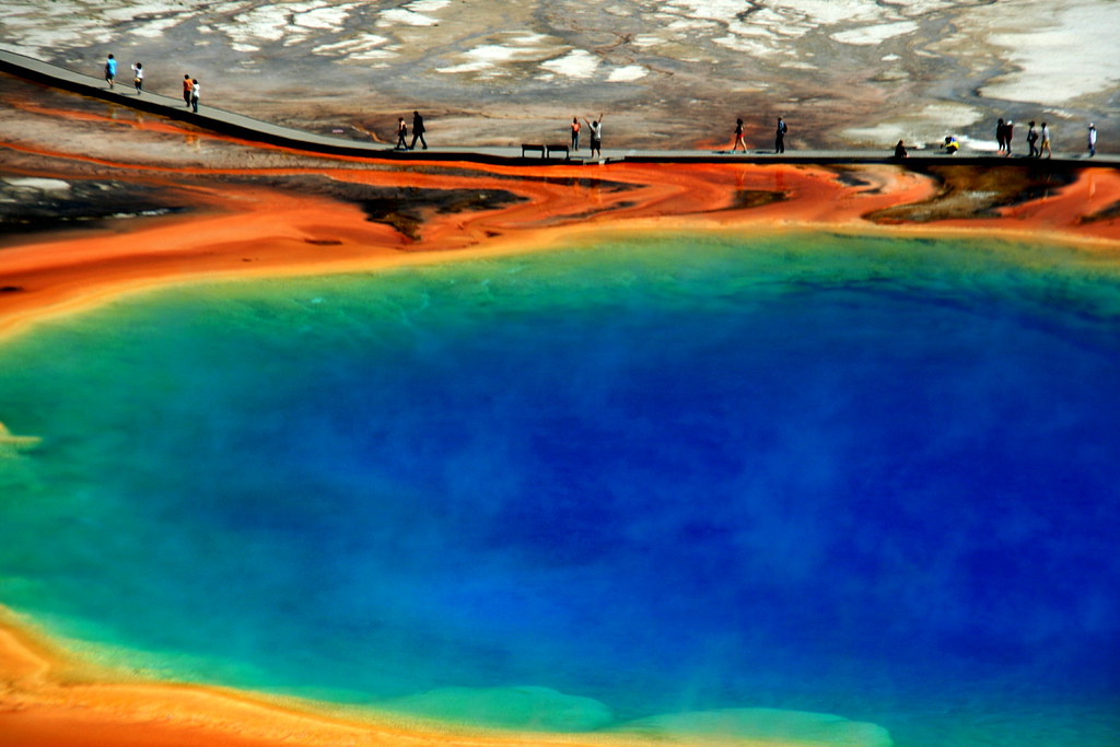
Boardwalk at Grand Prismatic

Is that democratic?  Most visitors – about 97% – want to experience Yellowstone from their automobile or a high-density, paved path. Why do we keep them away from the petrified forest?  Automobile sightseers are restricted to a single petrified tree just off the park road, and that tree is surrounded by a fence.  Even that lonely tree is inaccessible to recreational vehicles. Is that fair? Or should the park keep some destinations away from the vehicles, recognizing that hikers have some “right” to physical challenge?

Parks are for people


When you ask those questions you realize that Yellowstone’s geology starts to open up all sorts of questions about political values.  What are national parks for? Who are they for?

Some might argue that Yellowstone should serve the vast majority of Americans who want to go sightseeing only a short distance from their automobiles.  Others might emphasize the wilderness experience that can be found only in the larger national parks. Still others might move away from human needs and argue that only large wilderness areas can protect intact, well-functioning ecosystems.

Those are the big topics of the national parks. Geology may not be a politically-salient topic, but it turns out that you can find political themes if you use the geology to play tourist.

Lamar Valley from Specimen Ridge

If you’re interested in geology, and to some degree even if you’re not, I recommend Geology Underfoot in Yellowstone by Marc Hendrix.

For a fascinating view of the human footprint on the geologic record, see Jan Zalasiewicz’s The Earth After Us: What Legacy Will Humans Leave in the Rocks?

Photos from the 2013 Yellowstone course are on Flickr.