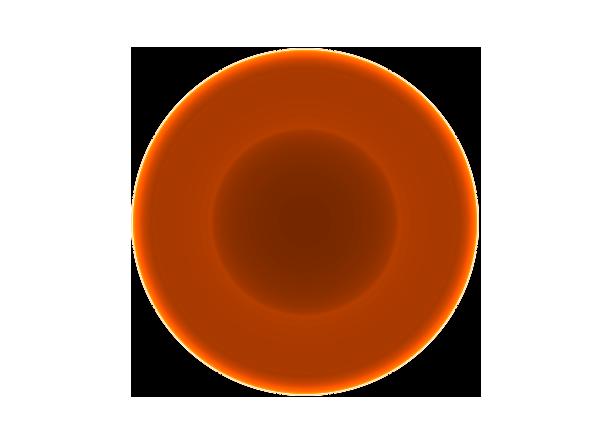
Simulation of the Earth as seen in geoneutrinos as observed just under Earth’s surface.
Center of plot is the nadir direction (underfoot), and outermost circle is horizon.
We see that the brightest emission is from angles near the horizon, due to the concentration of uranium and thorium in the Earth’s crust.
Citation: Fields & Hochmuth (2006)